Pembrokeshire, Wales
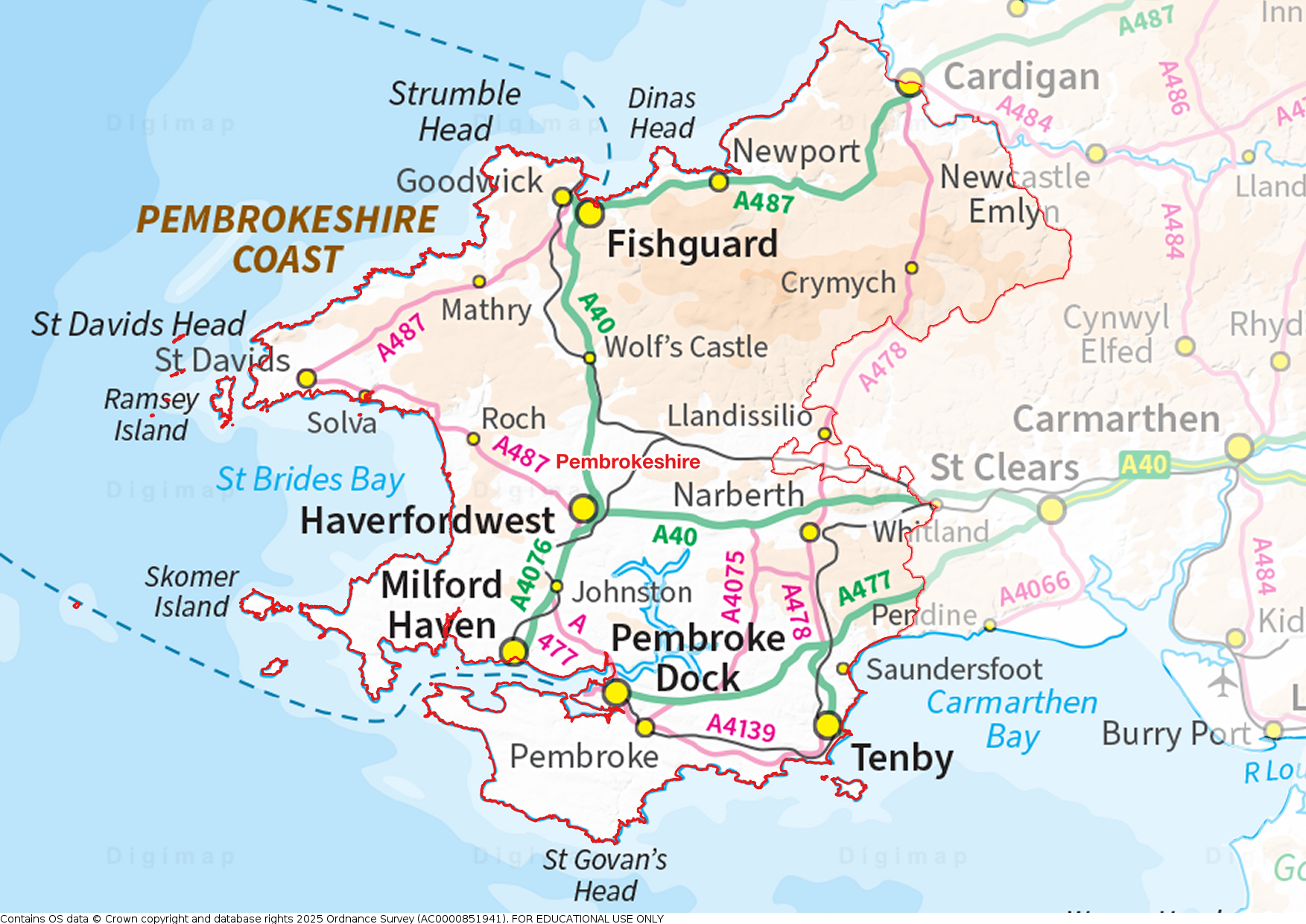
 Pembrokeshire (Sir Benfro) is a maritime county in west Wales. The long coast of Pembrokeshire is a spectacular seaboard. From the Teifi estuary the coast runs south to the broad sands of the Nevern mouth and Newport, then with wild cliffs and headlands past the ferry port of Fishguard out to St David’s Peninsula opposite Ramsey Island. The cathedral city of St David’s is where Wales' patron saint established his monastery in 550. The coast then opens into St Bride’s Bay and, to its south, the spectacular cliffs of the Marloes Peninsula with the seabird sanctuaries of Skomer and Skokholm offshore. To the south is Milford Haven, a broad deepwater inlet which serves the major ports of Milford Haven and Pembroke Dock. Pembroke has a magnificent castle. The county's south coast includes the resorts of Saundersfoot and Tenby. Inland, most of the county is rolling countryside with small villages. Haverfordwest serves as the main market town.
 Portrait of Pembrokeshire
Place Type: Historic County
Alternative name(s): Sir Benfro
Lat, Long: 51.858613,-4.870795
Grid Reference: SN 0240 2167
Devolved Legislature: Welsh Assembly (Senedd)
GBPN ID: 305782
GGA Code: C01000068
Entry Type: Main listing (P)
URL: https://gazetteer.org.uk/place/Pembrokeshire
 Explore Pembrokeshire on Wikishire
The land which became Pembrokeshire was an important centre of Bronze and Iron Age culture. The north-west of the county, especially around the Preseli Hills, has numerous megalithic monuments, e.g. dolmens, standing stones and stone circles. The Preseli Hills, a wide stretch of high moorland, were the source of the bluestones used in the construction of the inner circle of Stonehenge. Pentre Ifan is the largest and best preserved Neolithic dolmen in Wales.

Pentre Ifan
From the north, the spectacular coast of Pembrokeshire begins at the Teifi estuary, across which lies Cardiganshire. From there the coast runs south to the broad sands of the Nevern mouth and Newport, then with wild cliffs and headlands (past Fishguard, a port for ferries to Rosslare) out to the westernmost headland opposite Ramsey Island. This spur is the St David's Peninsula. Here is St David's: a village which is a city. It has a cathedral which is said to be the biggest church in Wales. Saint David established his monastery here in AD 550.

St David's Cathedral
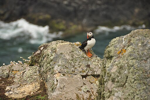
The western part of the coast opens into a big mouth some ten miles across: St Brides Bay, at the south of which is the Marloes Peninsula. Off the peninsula is the uninhabited island of Skomer, best known for its large breeding seabird population, including Manx Shearwaters, Guillemots, Razorbills, Cormorants, Kittiwakes, Puffins, Storm-petrels, and Shags. It is also a scheduled Ancient Monument for its stone circle, standing stones and remains of prehistoric houses. To the south lies Skokholm island. Battered by storms, the high cliffs and isolated nature of the island makes it a haven for seabirds.

Puffin on Skomer
South of the Marloes Peninsula is the Milford Haven Waterway, the finest natural harbour in the world according to Nelson. Milford Haven is a broad deepwater inlet, and serves two major ports; the town of Milford Haven and Pembroke Dock. The banks of the Milford Haven Waterway are dominated by the oil and gas industries. The Haven runs far further inland though, deep into Pembrokeshire and forming a great inland system of seawater creeks and channels into the heart of the county.

Milford Haven
The town of Pembroke is a modest town, largely serving its port. Pembroke Castle is a spectacular mediæval castle sited on a strategic rocky promontory by the Cleddau Estuary. The castle was the original seat of the Earldom of Pembroke. In 1093 Roger de Montgomery built the first castle at the site when he fortified the promontory during the Norman advance into Wales. A century later this castle was given to William Marshal by Richard I. Marshall rebuilt Pembroke Castle in stone, creating most of the structure that remains today. Henry Tudor was born in the castle in 1457.

Pembroke Castle
The south-east of the county contains the major resorts of Tenby, with its 13th-century mediæval town walls, and Saundersfoot. Manorbier Castle, standing above the beach in the village of Manorbier, was the original seat of the Anglo-Norman de Barry family. Carew Castle is a Norman castle which stands on a limestone bluff overlooking the Carew inlet — a part of the tidal estuary that makes up Milford Haven.

Tenby Beach
The small inland town of Narberth is known for its range of independent shops. The ruined Norman Narberth Castle stands in the town. Llawhaden Castle (Cadw), near to Narberth, was built by the bishops of the Diocese of St David's between the 12th century and 14th century. Oakwood Theme Park and Folly Farm are hugely popular tourist attractions in this area.

Llawhaden Castle from the village
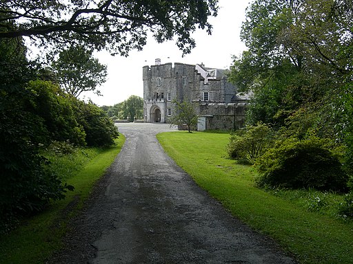
Away from the coast, the county is rolling countryside with small villages. The county is famous for its Pembrokeshire Earlies potatoes. The only large inland town, Haverfordwest, serves as the market town for most of Pembrokeshire. Haverfordwest Castle, standing in the town centre, was established in 1120 but much of the architecture remaining today is dated to 1290. Picton Castle is a mediæval castle to the east of Haverfordwest. Originally built at the end of the 13th century by John Wogan, it is still inhabited by his descendants, the Philipps family today. Wiston Castle, to the north-east of the town, is a motte and bailey castle, abandoned during the 13th century.

Picton Castle
In ancient times Pembrokeshire formed the Welsh region of Dyfed. In 877 Dyfed fell nominally under the sway of the princes of South Wales. The Normans arrived between 1067 and 1111. Pembroke Castle was founded in 1093. Further Norman adventurers penetrated further north and built a string of castles where they came. The Earldom of Pembroke and a County Palatine, Pembrokeshire, were created in 1138 and conferred upon Gilbert de Clare. The Welsh princes were hostile to the incomers and the Norman and Flemish presence was precarious. Nevertheless, southern Pembrokeshire was secured and settled, protected by castles up to the Preseli Hills. Flemish settlers arrived in the region during the 12th century, and, as a result of strong Norman defenses, the south, known as “little England,” was better populated than the north and maintained closer contact with England.

Carregwastad Point with memorial to the Last Invasion of Mainland Britain
In 1457, Henry Tudor was born at Pembroke Castle to Margaret Beaufort, the Lancastrian heiress. It was his son, Henry VIII who formally established the earldom of Pembroke as a shire (county) by the Laws in Wales Act 1535. The county remained mainly rural, with small fishing and whaling industries, during the Industrial Revolution. Pembrokeshire was the scene in 1797 of the last armed invasion of Great Britain. On the evening of 22 February 1797, the Légion Noire of the French Republic landed at Carregwastad Point, 1,400 strong. The Pembroke Yeomanry and local volunteers swiftly drove the French back. The French surrendered the next day.
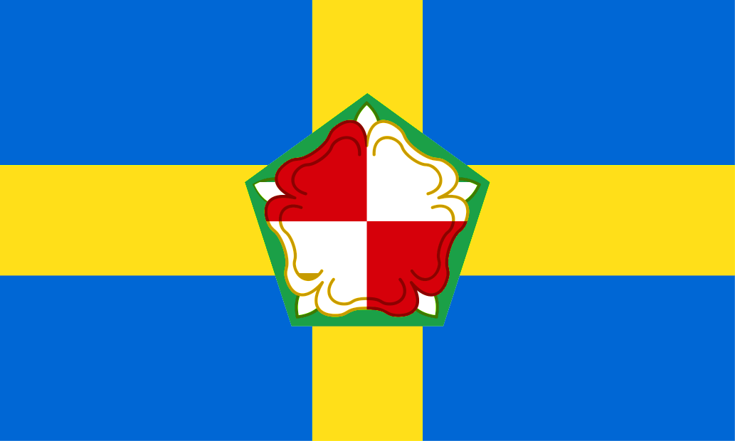
The Pembrokeshire Flag comprises a central Tudor rose (the symbol of Henry VII) on a yellow cross (to represent the summer sunshine) on a blue background (to represent the sea). Pembrokeshire Day is celebrated on 1st June each year.

The Pembrokeshire Flag at Bosherton


 Menu
Menu