Menu
MenuWall Map of the Historic Counties of the UK
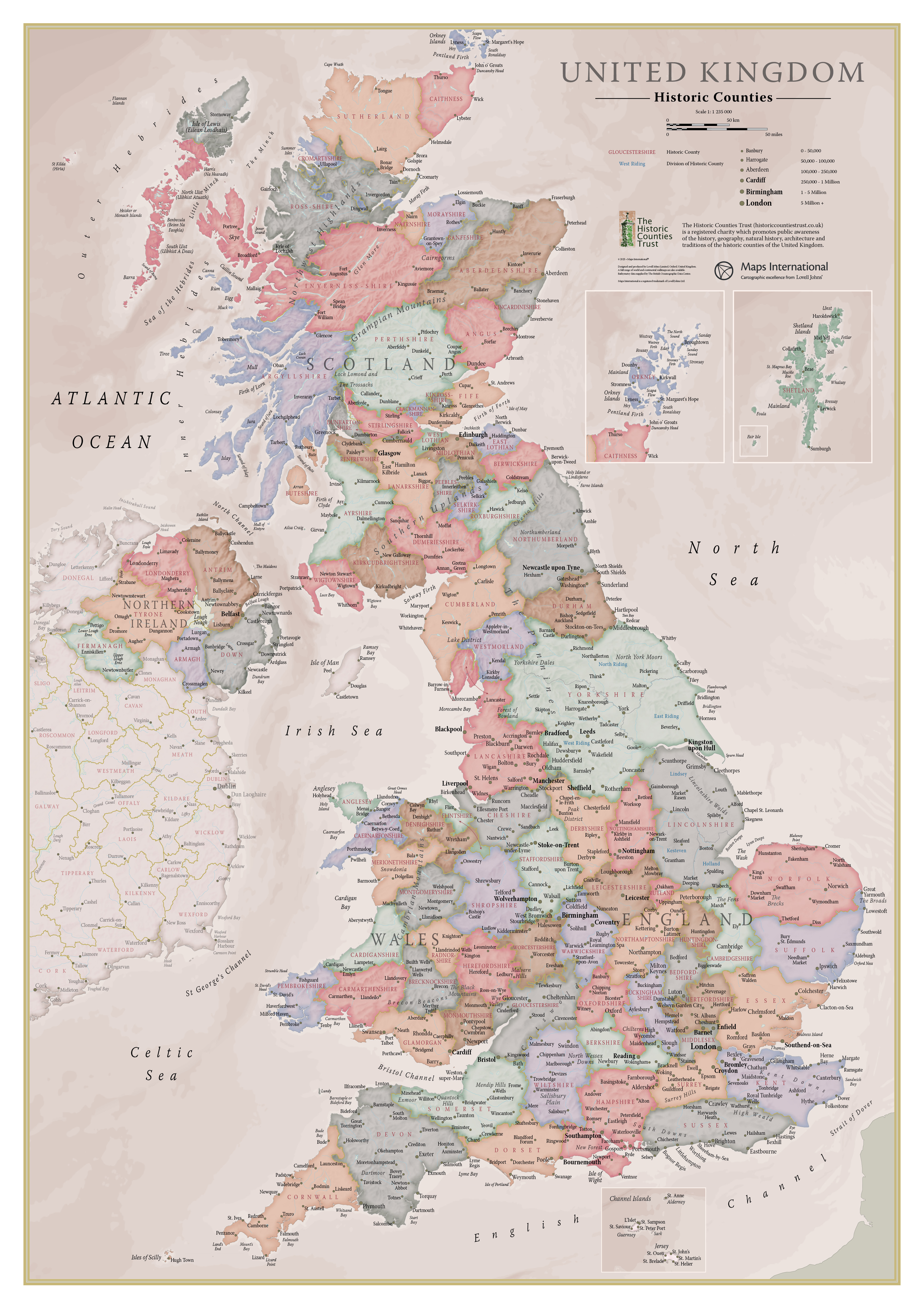
The Historic Counties Trust's wall map of the Historic Counties of the United Kingdom is available from Stanfords: The A1 map features every historic county, as well as the Ridings of Yorkshire and the Parts of Lincolnshire. Major towns and cities are highlighted, along with hill and sea shading. The map is finished with write-on front sheet lamination. The map was created for the Historic Counties Trust by the expert cartographers of Lovell Johns. The price is £9.99 + P&P.