
 Menu
MenuNotes for Historians, Archivists and Genealogists
These notes are intended to enable historians, archivists and genealogists to make full use of the information contained in the Gazetteer.
1 Introduction - the county basis of historical studies
2 Recording and promoting the historic environment: ancient monuments, historic buildings etc.
3 Cataloguing, indexing and archiving of historical documents and artefacts
4 Presentation to the public of material relating to history
5 County record offices
6 Determining the location of a place from an historical reference
7 Determining the Registration District of a place
8 The differences between historic counties, registration counties and administrative counties
1 Introduction - the county basis of historical studies
The historic counties are the pre-eminent territorial divisions of Great Britain and Ireland. Their long lives and the place they play in our history and our sense of place make them the natural basis for the study and description of our geography, history, natural history, architecture and culture.
The production of chorographical descriptions of Great Britain and Ireland on a county by county basis dates back at least as far as the first publication of William Camden's Britannia in 1586. Innumerable gazetteers, place name indexes and topographical dictionaries have subsequently followed this approach. Among the best known are Batholomew's Survey Gazetteer of the British Isles; John Marius Wilson's Imperial Gazetteer of England and Wales and Imperial Gazetteer of Scotland; and Samuel Lewis' A Topographical Dictionary of England and its companion volumes to Ireland, Scotland and Wales.
The late 16th century also saw the first publication of detailed historical and topographical accounts of individual counties, what have become known as 'county histories'. William Lambarde's Perambulation of Kent (1576) is considered the earliest of these. George Owen's The Description of Pembrokeshire (c.1603) is an early Welsh example. Charles Smith’s The Ancient And Present State of The County And City Of Waterford (1746) is an early example from Ireland. Scottish examples, such as John M. Leighton's History of the County of Fife, appeared from the early 19th century. A county history generally encompass the county's geography, genealogy, architecture, customs, and notable events from prehistoric times to the modern era.
A closely related genre, which emerged in the second half of the 17th century, was the county 'Natural History', which focused on the county's flora, fauna, natural phenomena, and also often covered its antiquities. Early examples include Robert Plot's volumes on Oxfordshire (1677) and Staffordshire (1686) and John Aubrey's work on Wiltshire.
The county-basis for the study of local history was further cemented in the Victorian period by the establishment of county-based antiquarian societies. The Victoria County History, begun in 1899, represents the cornerstone of modern English county histories, producing encyclopaedic volumes for every county in England.
Despite the confusions caused by the creation and endless reorganisation of local government since the late 19th century, the study and presentation of history on the basis of the historic counties continues to the present day, as do the Victoria County History and most of the county-based antiquarian societies.
The Gazetteer is presented both as a part of this fine tradition and to help facilitate its continuation.
2 Recording and promoting the historic environment: ancient monuments, historic buildings etc.
The Gazetteer, along with the digitised county border data available from the Historic Counties Trust, will enable any site or area of the historic environment to be ascribed to its historic county.
The United Kingdom contains many thousands of archaeological sites, ancient monuments and historic buildings. The cataloguing of such sites began in the 19th century and was, until recent times, almost always undertaken on the basis of the historic counties. Similarly, publications and public presentations of such sites were either done on a historic county basis or at least with reference to the county of each site. This approach has commonly been used for all such sites, including antiquities that date from an era prior to the formation of the counties.
Whilst modern databases enable the historic environment to be recorded against multiple forms of contextual data, there are sound academic reasons for continuing to record sites against historic county. This will ensure that records are maintained against that stable geography in use since the earliest of such studies. It will also facilitate the presentation to the public of such sites within a relevant geographical context.
The Department for Communities in Northern Ireland records its historic sites against townland, civil parish and county, and presents them to the public in these contexts.
The National Monuments Records of Wales, maintained by Royal Commission on the Ancient and Historical Monuments of Wales, includes an 'Old County' field for all the site records within it, reflecting the fact that the collection was built up on the basis of the 13 historic counties.
The Atlas of Hillforts of Britain and Ireland (Lock and Ralson 2024) is an excellent example of the use of the historic counties for cataloguing and presenting archaeological sites.
There are, however, major areas where the present-day recording and promotion of the historic environment apparently overlooks the historic counties. Historic England, Cadw and Historic Environment Scotland do not appear to record historic county in the official records of the scheduling of ancient monuments or the listing of historic buildings. The British Listed Buildings website, however, does link each listed building to its historic county.
Of the many records of the historic environment of England available through the Heritage Gateway, few currently link a site to its historic county. This could easily be rectified. For example, the Historic Environment Records (HERs), while organised on the basis of local government areas, could easily also be linked to the historic counties.
The owners of many heritage sites, especially major bodies including the National Trust, National Trust for Scotland, English Heritage and Cadw, also often neglect to catalogue and present these properties within the context of their historic county.
3 Cataloguing, indexing and archiving of historical documents and artefacts
The Gazetteer, along with the digitised county border data available from the Historic Counties Trust, will enable a document or artefact to be catalogued and indexed on the basis of its historic county.
Modern cataloguing, indexing and archiving systems enable items to be recorded with a wealth of contextual data. Among this data should be the relevant historic county. This will enable the retrieval and study of items based on historic county, an important geographical framework for many items and many studies.
4 Presentation to the public of material relating to history
The Gazetteer, along with the digitised county border data available from the Historic Counties Trust, may be useful to museums, libraries and record offices in presenting historical documents and artifacts to the public in the relevant historical and geographical context.
The presentation of documents and artefacts to the public by reference to their present-day local government area can be highly incongruous, especially where such items predate the very creation of modern local government in the late 19th century.
Some documents and artefacts, of course, relate to one form of administration of another, and should be presented in that context. More generally, items are more appropriately presented by reference to their historic county.
5 County record offices
The concept of the "county record office" or "county archives" began with the establishment of Bedfordshire Record Office in 1913 and subsequently developed across most of England and Wales. The record offices were set-up and run by local authorities, though in an era where council areas largely coincided with the historic counties. In general, each was initially intended as a repository for the records of a particular historic county.
A county record office may contain the county's parish records along with church records relating to other denominations and records relating to independent local organisations, schools, prominent families and their estates, businesses, solicitors' offices and so on.
Few local authorities now cover an area anything like that of any historic county. And yet it is within record offices maintained by the local authorities that records relating to the counties are to be found. The approach of local authorities varies. Some try only to keep records of places which lie within their area, others try to keep records of the whole of the historic county which shares the name of their area. This leads to absurd complications. For example, the parish registers for the historic county of Warwick can be found scattered between record offices in Birmingham, Warwick, Gloucester, Coventry and Worcester.
With further local government changes an inevitability, consideration should be given to whether a more consistent approach to local record keeping should be taken. The alternative would seem to be the increasing fragmentation of local historical records and their maintenance by bodies which have a geographical basis radically different to the historic counties which form the natural basis on which these records should be kept.
The Gazetteer lists the full local government information for each place and, hence, provides a starting point as to where records related to a particular place may be found. However, a little research is usually needed to determine the correct repository of a particular set of records.
6 Determining the location of a place from an historical reference
The Gazetteer can be used to determine the location of places found in historical records and references which list place name and county, e.g. the "Where Born" column of Census returns.
The Gazetteer lists the historic county of more than 300,000 places in the United Kingdom. It contains commonly accepted spelling variations of place names including Welsh and Gaelic versions. It includes the Ridings of Yorkshire and the Parts of Lincolnshire. It provides details of the county for places both prior to and following the Counties (Detached Parts) Act 1844.
The Gazetteer's listing of over 50,000 settlements gives it an advantage over some Census place name indexes which only include the names of parishes. Within a parish there can be several separate settlements each with its own distinct name and identity. Some are recorded in Census Reports as "townships" or "tythings". However, many identifiable "places" do not fall into these categories and are omitted from Census place name indexes. This is particularly true in the case of the large number of towns and villages which have developed since the 18th century.
The gazetteer includes the townlands and civil parishes of Northern Ireland, invaluable in determining the location of places from historical records relating to the six counties.
The gazetteer includes the civil parishes of England and Scotland and the communities of Wales. Many of these retain the names and areas of ancient parishes stretching back many hundreds of years, making the Gazetteer useful for locating parish references from many historical sources which relate to the pre-civil parish era.
7 Determining the Registration District of a place
Registration districts throughout the UK are now aligned with the top tier council areas, which can be ascertained from the Gazetteer. Copies of birth, death and marriage certificates can be obtained directly from the local register office at which the registration was originally made, or from that office to which the registers have been moved by subsequent reorganisation.
The Gazetteer does not provide a record of the numerous registration districts which have existed since the introduction of civil registration. However, most former registration districts used the name of an existing parish, town or county. Consequently, locating the relevant current registration district should be straightforward from most historical references.
8 The differences between historic counties, registration counties and administrative counties
Some reference works present a simplistic view of the counties of the UK, one in which there existed from ancient times a set of counties and in which there was little by way of change to these counties until 1974. In 1974, so one might be led to believe, these counties were radically altered. This approach gives the impression that one needs to be aware of two types of county, 'pre-1974 counties' and 'post-1974 counties'.
This oft-repeated nonsense can lead to an incorrect understanding of the geographical frameworks on which historical records are based and/or to misunderstand the meaning of a reference to "county" in any particular historical document.
There are three distinct sets of areas which historians and genealogists need to be aware of, each of which can be described by the word "county", with or without further qualification. These are the historic counties, the "registration counties" and the "administrative counties". There are also the "parliamentary counties", but these tend not to crop up in documents of genealogical interest.
In this section we explain the nature of each of these three distinct sets of areas. We describe the the relationship between them and outline the contexts in which each is likely to be encountered in historical documents.
8.1 The historic counties
First and foremost the unqualified word "county" should be used to refer to one of the 92 historic counties of United Kingdom. We discuss the nature and importance of the historic counties in the Main Features of the Gazetteer
The Historic Counties Standard, published by the Historic Counties Trust, provides a comprehensive definition of the names, areas and borders of the historic counties of the United Kingdom. The Standard also provides background information on the history of the historic counties; the mapping of their bounds; and of the confusion caused since the late 19th century by the use of the word "county" to also refer to various statutorily defined administrative areas. The adjective 'historic' is, of course, of relatively recent origin and is used to attempt to clear up this confusion.
Prior to the introduction of civil registration in 1837 (see below), the only ambiguity concerning what was or was not a "county" concerned the status of the "counties corporate"; those towns or cities which various statutes had given the title ‘county of a town’ or ‘county of a city’ along with some of the administrative functions then associated with a county. The county corporate status was generally seen as an extra civic dignity and not usually taken to mean that the town had literally been removed from its host county. The Censuses of 1801-1831 were all enumerated and published using the counties as their basic geographical framework. These, and subsequent Censuses, all included each county corporate within the returns and reports for its host county.
A further small ambiguity arose from the Counties (Detached Parts) Act 1844. Prior to this Act, there were many small parts of one county which lay detached from the main body of that county and entirely within another county. The 1844 Act deemed that from 20th Oct 1844 most of these detached parts in England and Wales were to be considered "for all purposes" to form part of the county within which they were locally situate. Whether this was meant to be a real territorial change is debatable. Nonetheless, it was generally taken as such, for example on OS maps and by the GRO in the Census Reports from 1851 onwards.
In the place name entries, the Gazetteer notes where a place lay in a detached part affected by the Counties (Detached Parts) Act 1844. The place name entries for the detached parts (exclaves) themselves also note this. Appendix A presents an alphabetical list of the parishes, hamlets, and townships affected by the Act. Those seeking records (in particular parish registers) from places within this list need to take extra care that they have found the correct repository for these records.
8.2 The registration counties
The "registration counties" of England and Wales were artificial entities created by the Registrar-General in the mid-nineteenth century to facilitate the enumeration and analysis of the Censuses. They ceased to be used by the General Register Office (GRO) following the 1921 Census. An understanding of what they were is important for anyone seeking to use Census returns for studying family history or using the actual published Census Reports for historical studies.
The origins of the registration counties lay in the Poor Law Amendment Act 1834. For the purposes of the provision of relief to the poor this Act divided the whole of England and Wales into "Poor-Law Unions". Within each Union the relief of the poor was made the responsibility of an elected Board of Guardians. The Unions were formed by grouping parishes together. In many cases a particular Union would contain parishes from two or more different historic counties.
The process of civil registration in England and Wales was first established by the Act for the Registering of Births, Deaths and Marriages 1836. A Registrar General was appointed as head of the national system of civil registration. The whole of England and Wales was divided into Registration Districts. In most cases the Registration Districts were coterminous with the existing Poor-Law Unions. A Superintendent Registrar, responsible for the registration of births, deaths and marriages, was appointed to each Registration District. The Registration Districts were further subdivided into sub-districts. To each sub-district was appointed a registrar of births and deaths. Each Registration District comprised typically 3 or 4 sub-districts and each sub-district comprised several parishes. Because the Registration Districts were usually identical to the Poor-Law Unions and these Unions often crossed historic county boundaries, then many of the new Registration Districts, and some sub-districts, also crossed county boundaries.
The new civil registration system was henceforward made use of by the GRO for the enumeration of the Censuses of England and Wales. This was done by dividing each registration sub-district into several enumeration areas. An enumerator was appointed to each enumeration area. He was responsible for distributing the household forms to each household in his area and for collecting the completed forms. He then had to copy the information on these forms into his "enumerators' books". The registrar of each registration sub-district then received copies of the enumerators' books from all the enumeration areas in his sub-district. He checked these and forwarded them to the Superintendent Registrar of his Registration District. He then checked all the books from his Registration District and forwarded these to the Registrar-General.
The 1841 Census was the first to make use of the new civil registration areas in this way. However, once all the enumeration books were assembled at the GRO, the records were then re-ordered into historic county order, i.e. the returns for all parishes in a single county were collected together even though this involved splitting records from some Registration Districts. This means that the published reports from the 1841 Census and the filmed copies of the enumerators' books are based on the historic counties, despite having been enumerated on the basis of the Registration Districts.
However, the returns for the 1851 Census (and all those up to and including 1921) were treated in a different way. For this Census the Registrar General defined a set of "registration counties". Each registration county was formed by grouping together all those Registration Districts which lay predominantly in a particular historic county. So, for example, if 70% of a Registration District lay in the historic county of Berkshire then the whole of that Registration District was deemed to lie in the "registration county" of Berkshire. Hence whilst the registration counties shared the names of the historic counties there were often significant differences in area between them.
The Registrar-General also defined 11 registration "Divisions" (e.g. North Western, West Midland, South Eastern etc.). These divisions were made by grouping together the registration counties. A "London" division comprised the parts of the registration counties of Middlesex, Surrey and Kent within the limits of the Registrar-General's bills of mortality. The published Census Reports presented extensive statistical analysis for each division and of each registration county. However, these reports also presented similar statistics for the "counties proper" (i.e. the historic counties). Students of these Census Reports should take care to establish which type of county is being discussed in a given context.
From the 1851 Census onwards, the actual enumerators' books were not re-ordered into historic county order (as the 1841 returns had been). They were stored in division order and, within each division, in registration county order. Subsequently these records have been filmed and indexed in this order. Genealogists need to be aware that the references to "county" in the Place Name Indexes to the Census returns from 1851 onwards are to registration county and NOT to historic county. Appendix B provides a list of those parishes, townships etc. which lay in a registration county of a different name to their historic county at the time of the 1851 Census. Appendix C presents a similar list for the time of the 1881 Census.
Like all administrative areas, the names and areas of the Registration Districts have frequently been altered. Such changes, of course, led to changes in the areas of the registration counties between each Census. However, the areas of the registration service were not generally altered following the creation of the administrative counties and county boroughs by the Local Government Act 1888 (LGA 1888). The only change was that the Registrar-General created a new registration county of "London" almost coterminous with the newly created administrative county of London. This new registration county formed the whole of the London division. Since the metropolitan parts of Kent, Surrey and Middlesex had been enumerated and indexed separately from the rest of the registration counties since 1851, this made little difference to the way in which the Census was conducted or ordered.
The Local Government Act 1929 abolished the Poor-Law Unions and assigned their functions to the administrative county and county borough authorities. The Act also facilitated the re-arrangement of the Registration Districts so as to lie within administrative county and county borough boundaries. From this time, the GRO gave up on the idea of registration counties. Censuses were henceforward enumerated and reported on the basis of the administrative counties and county boroughs (within which the Registration Districts now lay). The Local Government Act 1972 continued this practice and today Registration Districts in England and Wales are based on administrative counties / unitary authority areas.
Civil registration in Scotland began with the passing of the Registration of Births, Deaths and Marriages (Scotland) Act 1854. This Act established the General Register Office for Scotland headed by the Registrar General (for Scotland). By 1855 Scotland had been divided into 1027 Registration Districts. These Registration Districts generally were either whole parishes or sub-divisions of parishes.
The Scottish Census of 1861 was the first to be conducted by the Registrar General for Scotland. The Registrar General created "registration counties" to assist in the enumeration and evaluation of the Census. Each registration county was comprised of all those Registration Districts which lay predominantly in one particular county. However, the Scottish Registration Districts were closely based on the parishes. Therefore, it was generally only in places where a parish lay partly in two counties that the registration counties differed from the counties themselves. In such cases the whole of the parish would be deemed to lie in that registration county with the same name as the county within which the greater part of the parish lay. Therefore, there was a much closer correspondence between the counties and the registration counties in Scotland than in England and Wales. A list of those parishes concerned is provided in Appendix D.
Full civil registration in Ireland began in 1864, though the registration of non-Catholic marriages had begun in 1845. The existing poor-law unions, first established in 1838, were used as the registration districts. Registration counties were formed for statistical purposes in a similar manner to in England and Wales, by the grouping of poor law unions. However, few census records prior to the 1901 census exist, by which time enumeration was based within the administrative counties and county boroughs of the Local Government (Ireland) Act 1898.
8.3 The administrative counties and county boroughs
The era of modern local government began with the Local Government Act 1888 (LGA 1888). The LGA 1888 created a whole new set of statutorily defined administrative areas covering the whole of England and Wales, terming them "administrative counties" (two-tier local government areas) and "county boroughs" (single-tier local government areas). The Local Government (Scotland) Act 1889 created similar administrative areas in Scotland. The Local Government (Ireland) Act 1898 created a local government set-up of ‘administrative counties’ and ‘county boroughs’ similar to that created in England and Wales. The new areas were given elected councils to administer those functions assigned to them.
The areas of the "administrative counties" were initially based upon the historic counties (i.e. NOT on the registration counties). However, the administrative counties and the historic counties never had exactly the same areas for several reasons:
(i) Certain large towns and cities were made "county boroughs", independent of any administrative county.
(ii) The LGA 1888 specified that each urban sanitary district had to lie within a single administrative county. Many of the urban sanitary districts crossed historic county borders and hence, in these areas, the administrative county boundaries differed from those of the historic counties.
(iii) An administrative county of "London" was created covering the metropolitan parts of the historic counties of Middlesex, Kent and Surrey.
It should be understood that the LGA 1888 did not abolish or alter the historic counties. This fact was reflected in the Census Report of 1891. This distinguished between what it dubbed the "ancient or geographical counties" and the new "administrative counties". It made it clear that the two were distinct entities and that the former still existed, providing detailed statistics for both (and for the registration counties).
Almost immediately after they were created, the areas of the new administrative counties began to be altered both by Orders from the Local Government Board and by Local Acts of Parliament. The main aims of these changes were to iron out inconvenient boundaries and to extend administrative county or county borough boundaries to keep pace with expanding urban areas (e.g. Birmingham county borough was radically expanded into the administrative county of Worcester in 1911).
These generally small changes continued up to the 1960s during which decade much more radical changes took place. The London Government Act 1963 created the local government area of "Greater London" (and within it the London Boroughs). It also abolished the administrative counties of Middlesex and London and greatly curtailed the areas of the administrative counties of Surrey, Kent and Essex. Other major changes saw the creation of the administrative county of "Huntingdon and Peterborough" and the county borough of "Teesside".
Consequently, the pattern of administrative counties and county boroughs which existed immediately prior to 1974 was already radically different in many places to that of the historic counties.
8.4 The local government changes of 1974 in perspective
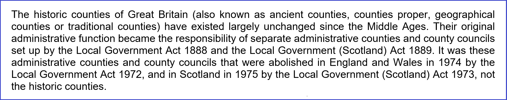
The local government reforms of 1974 in England and Wales were the result of the Local Government Act 1972 (LGA 1972). This Act abolished all of the "administrative counties" and "county boroughs" created by the LGA 1888 and created a whole new set of local government areas: "to be known as counties and in those counties there shall be local government areas to be known as districts."
Note that the LGA 1972 did not do anything to the historic counties. It only abolished the administrative counties and county boroughs. This is well expressed by the Office for National Statistics:
Whilst the "administrative counties" of the LGA 1888 had initially been closely based upon the historic counties, the LGA 1972's "counties" were, in many areas, radically different, not least in that the majority of the population of England found itself either in "Greater London" or one of six new "metropolitan counties" which bore no relation to any historic county. The LGA 1972 "counties" of Wales were also totally different from either the historic counties or the pre-1974 administrative counties.
The Local Government (Scotland) Act 1973 saw the creation of 9 "regions" the areas of which were generally unrelated to those of the counties.
The Local Government Act (Northern Ireland) 1972 declared that the administrative counties and county boroughs were to cease to be administrative areas for local government purposes. Since then local government service provision has been undertaken by district councils, initially 26 but now 11 in number, many of which cross historic county borders.
In truth, the names and areas of administrative units have, since the early 19th century, been subject to frequent and evolving change as the perceived needs of society have altered. The years 1974 and 1975 saw a particularly wide ranging set of such changes. However, such changes were not unique to these years and, in any case, neither these changes nor those previous to them had any effect on the historic counties.
Neither did changes to local government areas stop in 1975. Since then local government has been totally reformed again in Scotland, Wales and Northern Ireland and in many parts of England. To hold up 1974 as a single year to use as a reference by which to describe changes to local government areas would be a wholly inadequate way of describing the complex and continual changes to these areas. To quote 1974 as a year with some special relevance to the historic counties is just plain nonsense.
From the point of view of a historian or genealogist, a belief in the simple "pre-1974 counties" idea can lead to confusion since:
(i) It fails to draw a distinction between the historic counties and the registration counties. This distinction needs to be made if one is to understand the basis of the registration of births, deaths and marriages and the conducting of the Censuses until 1931.
(ii) It fails to draw a distinction between the historic counties and the post-1889 administrative counties and county boroughs. These latter were important administrative areas from 1889-1974. From the early 1930s the Registration Districts were also based upon them and the Censuses enumerated and reported on the basis of their areas. The administrative county and county borough authorities have also created their own historical records.
(iii) It fails to reflect the fact that long before 1974 in many areas the administrative counties were radically different from the historic counties.