
 Menu
MenuSearch the Gazetteer
Are the results not as expected? Modify your search term or change the scope to refine your search.
Results for a place that exactly matches ...
Surrey
Surrey, England
 Surrey is an inland county of southern England. Surrey is a relatively small county but heavily populated; in parts urban, suburban and rural. The north-east of Surrey lies within the metropolitan conurbation. In this area are Southwark, home of a Cathedral; Lambeth, home of the Archbishop of Canterbury; Brixton; Wandsworth; and the wealthy towns of Richmond upon Thames and Kingston upon Thames. Further from the metropolis, the suburban towns (including Sutton, Epsom, Banstead, Cobham, Leatherhead and Caterham) are clustered into the north and east of the county. Molesey, Walton-on-Thames and Weybridge lie on the Thames. The North Downs, a range of fine chalk hills and downland, stretch across Surrey from Guildford into Kent. The River Mole cuts through the Downs in a beautiful wooded valley. The River Wey has several towns on its banks, including Godalming and Guildford, the county town. Some miles west, linked to Guildford by the Hog’s Back ridge, is Farnham, a town with well-kept Tudor and Georgian buildings and a 12th-century castle. The ancient town of Woking lies in the north-east of the county.
Place Type: Historic County
Lat, Long: 51.294597,-0.277215
Grid Reference: TQ202564
Country: England
GBPNID: 305839
Entry Type: Main listing (P)
URL: https://gazetteer.org.uk/place/Surrey,_305839
 Explore Surrey on Wikishire
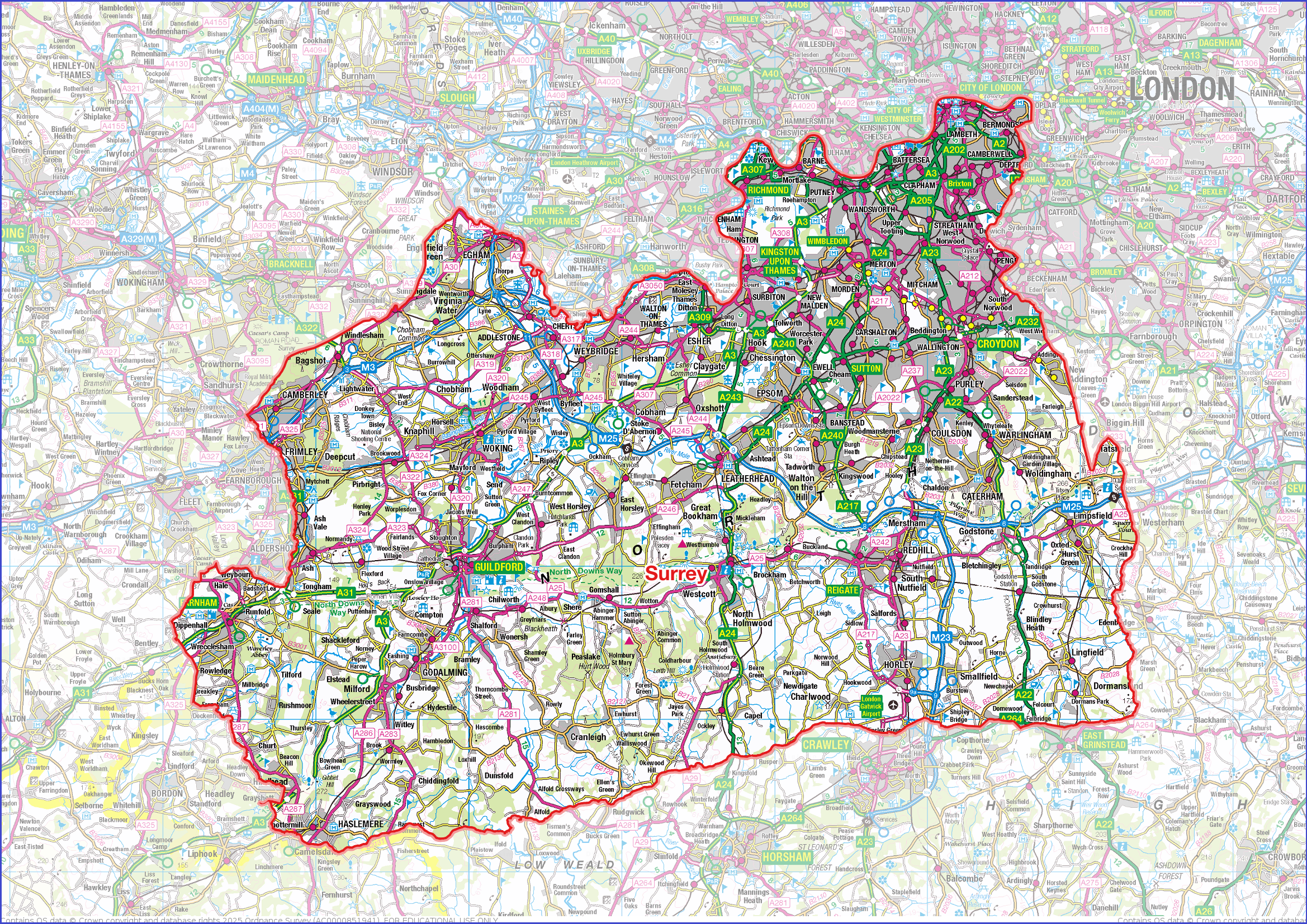

View from Box Hill on the North Downs
The north-east of Surrey lies within the metropolitan conurbation. Southwark is in the very northernmost part of Surrey on the River Thames immediately opposite the City of London. It forms one of the oldest parts of the London conurbation, having been effectively dependent on the City since the early Middle Ages. Southwark Cathedral, by London Bridge, is the seat of the Diocese of Southwark, which covers all of eastern Surrey. To the east of Southwark is Bermondsey, standing on the south bank of the Thames at the end of Tower Bridge. Bermondsey Abbey was a Benedictine monastery founded in the 11th century, centred on what is now Bermondsey Square. Rotherhithe stands on a peninsula in the Thames, facing the Isle of Dogs. Rotherhithe was a port from its earliest days. The Surrey Docks, close to the Kent border, have been redeveloped as a residential area known as Surrey Quays.

Surrey Quays, Rotherhithe
To the south of Bermondsey is Walworth, through which passes the ancient thoroughfare of Watling Street, known in this area as the Old Kent Road. South-east of Waltham is Peckham, which originally developed around the famous Peckham Rye Common, once a haunt of highwaymen and a place where William Blake saw visions. North-east of Peckham Rye is Nunhead, site of Nunhead Cemetery, and, east of that, is New Cross Gate, named after the New Cross tollgate established in 1718. South-east of Peckham is Dulwich, an affluent town and location of Dulwich College. Immediately west of Peckham is Camberwell, today a mixture of relatively well preserved Georgian and twentieth century housing.
.jpg)
Nunhead Cemetery
To the south of Southwark is Elephant and Castle. Named from the London underground station, itself named from a local coaching inn. Lambeth lies on the Thames to the south-west of Southwark. Lambeth Palace has been the main residence of the Archbishop of Canterbury since the Middle Ages. It stands close to the riverside opposite the Palace of Westminster. Vauxhall lies on the river to the south of Lambeth. Today it is a mixed commercial and residential district connected to Middlesex by Vauxhall Bridge. Nearby Kennington is best known as the home of the Surrey Oval, home of Surrey County Cricket Club, and of the Imperial War Museum. Battersea, on the Thames to the west, has three famous landmarks: Battersea Power Station, designed by Sir Giles Gilbert Scott, built between 1929 and 1939; Battersea Park, laid out by Sir James Pennethorne between 1846 and 1864, home to a zoo and the London Peace Pagoda; and Battersea Dogs and Cats Home, the UK's most famous rescue centre.

Peace Pagoda, Battersea Park
South-east of Battersea is Clapham, best known for its vast green space, Clapham Common, its vibrant high street and the village-like atmosphere of its historic Old Town. The urban districts of Stockwell, Brixton and Herne Hill lie east of Clapham. To the south of Clapham lie Streatham and Tooting. Wandsworth stands on the Thames west of Clapham. The River Front is a former wharf area, and now a long river walk. Wandsworth Common is set back from the river, at the top of East Hill. Putney, on the river to the west, is a significant centre for rowing. The parish church of St Mary The Virgin became the site of the 1647 Putney Debates, discussions among the New Model Army concerning the makeup of a new constitution for Britain.

Putney and Putney Bridge
To the west of Putney, the county has a more suburban character. Barnes, in a loop of the Thames, has the London Wetlands Centre and an historic village centre. Roehampton has retained something of its Georgian charm. East Sheen grew to be an affluent suburban town in the 19th century. The Boat Race has its finish point at Mortlake, marked by the University Boat Race stone just downstream of Chiswick Bridge.

Palm House, Kew Gardens
Kew is a prosperous town, best known for Kew Gardens, a UNESCO World Heritage Site. Other points of interest include Kew Palace and The National Archives. South of Kew is the prosperous town of Richmond. The river has a lively frontage around Richmond Bridge. Richmond is most famous for Richmond Park: a vast royal park, with large areas of wild heath and woodland originally enclosed by Charles I for hunting. It has herds of both red and fallow deer. North of the town, stretching up to Kew, is the Old Deer Park, a 360-acre Crown Estate landscape containing wide green lawns, sports facilities and the former King's Observatory erected for George III in 1769. The small town of Ham, on the Thames just south of Richmond, is the location of Ham House, a well preserved 17th century manor house.
Kingston-upon-Thames is an ancient market town built at the first crossing point of the Thames upstream from London Bridge. Kingston Bridge occupies the same site today. Kingston was occupied by the Romans, and later it was either a royal residence or a royal demesne. In 924 Kingston was the place at which Aethelstan was crowned King of the English; chosen both as King of the Mercians and of the West Saxons.
.jpg)
A boat on the river at Kingston-upon-Thames
To the south of Putney is the town of Wimbledon, world famous from the presence of the All England Lawn Tennis and Croquet Club, home to the Wimbledon Tennis Championships since 1922. Between them, Wimbledon Common, Putney Heath and Putney Lower Common provide 1,140 acres of open space. South-west of Wimbledon are the suburban towns of Merton, Morden and Mitcham. East of those, and south of Streatham, is Norbury, quiet countryside until the first Victorian villa was built in 1859, now a built-up residential area. Norbury Hall, built in 1802, remains. South of Norbury lies Croydon, with its large shopping centre and vibrant night-time economy.

Norbury Hall
Further from the metropolis, the suburban towns are clustered into the north and east of the county. Molesey, Walton-on-Thames and Weybridge lie on the south bank of the Thames. To their south are the large villages of Hersham and Esther, the latter the home to Sandown Park racecourse. Claremont Landscape Garden (NT), near Esher, is one of the earliest surviving gardens of the 'English landscape garden' style. At Chessington, south-east of Esher, is the Chessington World of Adventure theme park.

Claremont Landscape Garden
South-west of Esher is the town of Cobham. Cobham Mill, on the river Mole, is a red-brick water mill from 1822. South-east of Cobham is the town of Epsom, which developed as a spa town in the Georgian period. The mineral waters, rich in magnesium sulphate, are known as Epsom salts. Epsom Downs, part of the North Downs, are home to Epsom Downs Racecourse, a racing venue since at least 1661. The Derby has been run here, usually on the first Saturday of June, most years since 1780. Nearby Leatherhead, on the River Mole, is in the centre of Surrey and at a junction of ancient north–south and east–west communications. The town has been a focus for transport throughout its history, and remains so.
.jpg)
Carshalton Ponds
The main towns to the south of the metropolitan area include Carshalton, with Carshalton Ponds around the old village centre; Sutton, a significant retail district for surrounding towns; Banstead within the North Down (here known as the Banstead Downs); Coulsdon, on the northern edge of North Downs with many beautiful open spaces over the chalk downlands; Warlingham, high on the Downs with panoramic views; and Caterham, which lies in a valley cut into the dip slope of the North Downs.

Guildford castle
The brooks that run in the denes between the hills of Surrey have numerous beautiful villages along them. The Mole cuts through the Downs under Box Hill in a beautiful wooded valley. The Wey, further west, has several towns on its banks, including Guildford, the county town. Guildford is a large market town with an attractive high street. Guildford is built in a notch in the hills where the Wey breaks through, and the roads of the county try to force the same gap. On either side the town climbs the slopes, precipitously on occasion. The town and surrounding area has several historic properties. Guildford Castle is thought to have been built shortly after the 1066 invasion of England by William the Conqueror. Guildford Cathedral is a modern church, designed by Sir Edward Maufe built between 1936 and 1961. Clandon Park (NT) is an 18th-century Palladian mansion in West Clandon. Hatchlands Park is a red-brick country house with surrounding gardens in East Clandon. Loseley Park is a Tudor mansion built in the 1560s near Compton. Shalford Mill (NT) is an 18th-century watermill on the River Tillingbourne in Shalford, a little south of Guildford.

Loseley Park
Some miles west, linked to Guildford by the Hog's Back ridge, is Farnham, a town with well-kept Tudor and Georgian buildings and a twelfth-century castle once belonging to the Bishops of Winchester. The historic market town of Godalming lies four miles south-west of Guildford. The town traverses the banks of the River Wey in the escarpment of the Greensand Ridge. Oakhurst Cottage (NT) is a tiny 16th-century cottage in Hambledon near Godalming, restored as an excellent example of a Surrey labourer's cottage.
.jpg)
Oakhurst Cottage
Tucked away in the south-western corner of Surrey, close by the borders with Hampshire and Sussex, is Haslemere. It stands on the major route between London and Portsmouth. Gibbet Hill, to the north, was the site of executions in past centuries. Many of those hanged there were highwaymen, because the roads around Haslemere, particularly alongside nearby beauty-spot the Devil's Punch Bowl, were notoriously dangerous. Today, the heathland and woodland of the area is a popular attraction for walkers.

Devil's Punch Bowl from Gibbet Hill
North of Guildford is the large town of Woking. Woking is ancient in origin, appearing in the Anglo-Saxon Chronicle entry for 777. Modern Woking was formed in the area to the south of the Basingstoke Canal (opened in 1794) around the railway station, The original settlement, a mile to the south-east, became known as "Old Woking". The setting for the opening scenes of The War of the Worlds (1898), by H G Wells, is Horsell Common north of Woking.
Frimley is a small town of Saxon origin in the north-west of the county, in the Blackwater Valley, hard by the Hampshire border. Egham is a small town on the Thames to the north of Frimley. At Runnymede near Egham is the meadow in which King John sealed Magna Carta in 1215. Nearby Chertsey, where the River Bourne enters the Thames, is one of the oldest towns in England. It grew around Chertsey Abbey, founded in 666 by Eorcenwald, Bishop of London. Between Egham and Chertsey is Thorpe Park, a major theme park.

Runnymede Meadows
The south-east of the county is mainly rural and quiet with a few small towns. Dorking is an historic market town at the foot of the North Downs. Polesden Lacey (NT) is a Edwardian grand house on the North Downs at Great Bookham, north of Dorking. Reigate also lies at the foot of the North Down, further east from Dorking. Nearby Redhill stands immediately to the south of a gap in the North Downs through which roads and the railway have been driven, in particular the London to Brighton road. Oxted is a small town nestled at the foot of the North Downs, close to the Kent border.

Polesdon Lacy
South of these, on the Weald, is Horley, a commuter town with a significant economy of its own, including many business parks. Immediately south of Horley is Gatwick Airport, a gateway to London, and the consequent swathe of motorway corridor cutting through the farmland to meet the M25. The M25, the London Orbital, is itself an unavoidable feature of the Surrey landscape, with the motorway and all the junctions, slip roads and related equipment slicing through and reshaping the outer suburbs.
The area which became Surrey was relatively thinly populated during the Roman and early Saxon periods. During the 5th and 6th centuries the area was conquered and settled by Saxons. The name Surrey is derived from Suþrige, meaning "southern region", and this may originate in its status as the southern half of the Middle Saxon territory or the southern reach of Mercian territory. During the 7th century Surrey became Christian. Its most important religious institution throughout the Anglo-Saxon period and beyond was Chertsey Abbey, founded in 666. The abbey held land across much of the county. In 825, King Egbert of Wessex defeated the Mercians at the Battle of Ashdown and seized control of Surrey, along with Sussex, Kent and Essex. Surrey was incorporated into Wessex as a shire and continued thereafter under the rule of the West Saxon kings, who eventually became kings of all England. Following the Conquest large parts of the county belonged to the Norman nobility. Southwark, linked with London by the London Bridge, became an important ecclesiastical centre, and Kingston upon Thames was an important mediæval market town.

Reconstruction of a section of wall of Chertsey Abbey
Sheep farming became important from the Middle Ages. The cloth trade grew from the 16th century, centred around Guildford, Godalming, and Farnham. Market gardening became an important activity in the north and west of the county. The forested hills served as hunting preserves and as a source of timber for charcoal, construction, and shipbuilding. The coming of the railways in the 19th century had a profound affect on Surrey. Surrey acquired a extensive network of suburban railways, originating at seven terminals in the metropolis and covering northern and eastern Surrey. Suburban growth along the railway lines was virtually unchecked until after World War II, since when it has continued under planning restraints, including strict controls in the London Greenbelt.
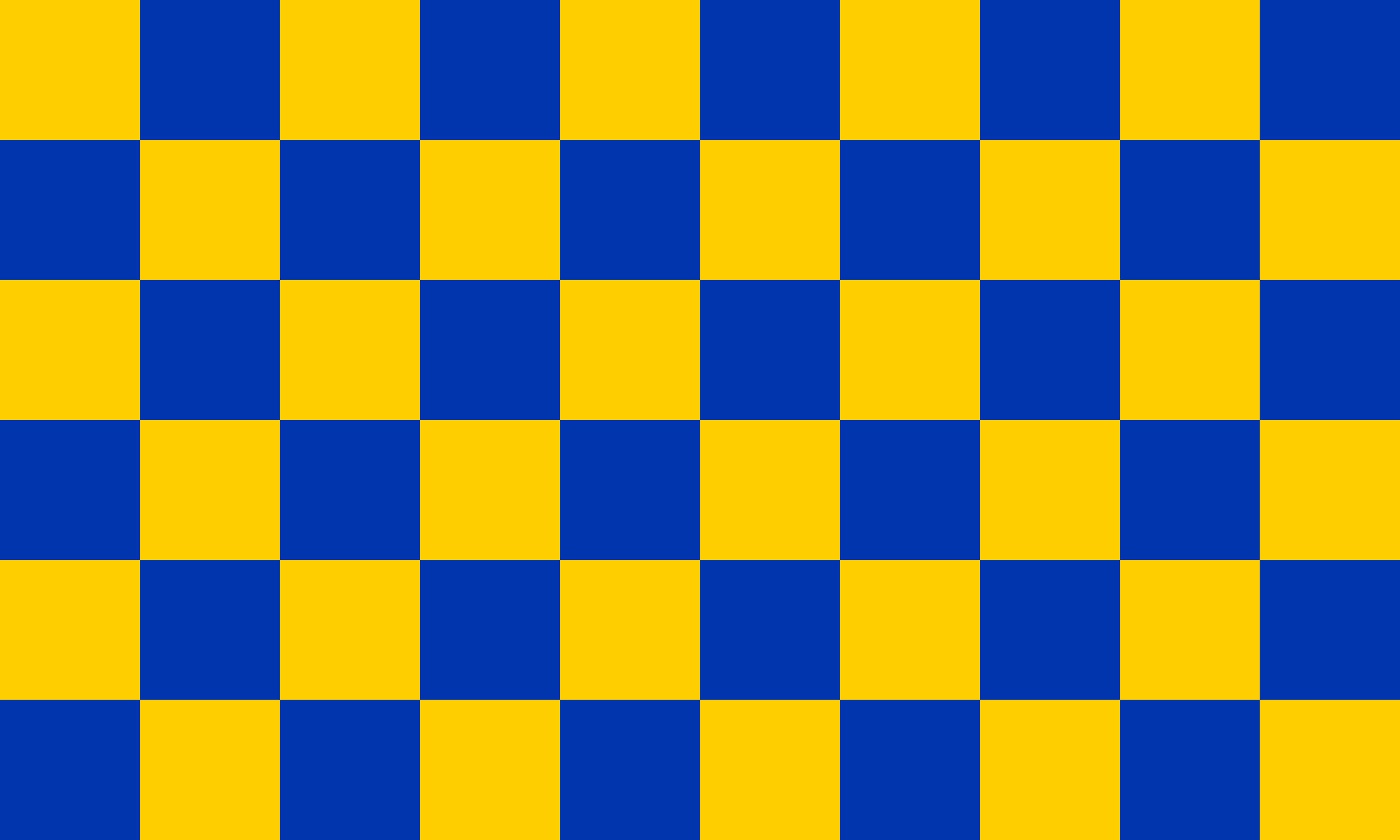
The Surrey Flag is a banner of blue and gold checks. The design was attributed in the 12th century to William de Warenne, the first Earl of Surrey. In time it became associated specifically with the county. Reference is made in the 17th-century poem on the Battle of Agincourt by Michael Drayton to such a banner being borne by the fighting men of Surrey. The pattern began to appear on the arms of numerous towns and boroughs in Surrey throughout the 19th and 20th centuries and also features in the insignia of a number of sporting clubs and other institutions in the county. Surrey Day is celebrated on the first Saturday in May each year.