
 Menu
MenuSearch the Gazetteer
Are the results not as expected? Modify your search term or change the scope to refine your search.
Results for a place that exactly matches ...
Shetland
Shetland, Scotland
 Shetland is a county formed from the archipelago of the same name. Shetland has around 100 islands, of which 16 are inhabited. The islands lie 50 miles north-east of Orkney and 110 miles from the mainland of Great Britain. The main sources of employment are agriculture, aquaculture, fishing, renewable energy, crude oil and natural gas production, the creative industries and tourism.
Place Type: Historic County
Lat, Long: 60.158453,-1.216635
Grid Reference: HU435418
Country: Scotland
GBPNID: 305809
Entry Type: Main listing (P)
URL: https://gazetteer.org.uk/place/Shetland,_305809
 Explore Shetland on Wikishire
Early in the Viking Period Shetland was settled by Norsemen, and whether they drove its previous population out or absorbed them, Shetland became a Norse land and almost all of Shetland's place-names are derived from the Norse language. In the days of King Harold Fairhair of Norway, Shetland became part of the new Earldom of Orkney, and it remained under the Norwegian crown until 1468, when it was given to King James III King of Scots as a pledge for a dowry, which pledge was not redeemed.
.jpg)
Commercial Street, Lerwick
The main island of Shetland is Mainland. Lerwick, the county town, is seated in the middle of the island, on the east coast, protected by the island of Bressay across the sound. From Lerwick to Sumburgh Head in the south, a spine stretches due south as a broad ridge, steep on the east but with its scarp plunging far down into the sea on the west incredibly steeply. North of Lerwick the island broadens, with a scattering of rock-bound islands deeply cut with voes (fjords). On the west coast of Mainland opposite Lerwick is the former capital, Scalloway, now a fishing port but home also to the remains of a mediæval earl's hall. Scalloway Castle is a ruined tower house standing above Scalloway. The tower was built in 1600 by Patrick Stewart, 2nd Earl of Orkney, during his brief period as effective ruler of Shetland. At Tingwall lies the Law Ting Holm, the location of Shetland's parliament until the late 16th century.
.jpg)
Fair Isle
The next largest islands are Yell, Unst, and Fetlar, which lie to the north of Mainland, and Bressay and Whalsay, which lie to the east. Muness Castle on Unst, built in 1598 for Laurence Bruce of Cultmalindie, half-brother to Robert Stewart, 1st Earl of Orkney, is the most northerly fortification in the British Isles. East and West Burra, Muckle Roe, Papa Stour, Trondra and Vaila are smaller islands to the west of Mainland. The other inhabited islands are Foula 17 miles west of Mainland, Fair Isle 24 miles south-west of Sumburgh Head, and the Out Skerries to the east.
.jpg)
Broch of Mousa
Due to the practice, dating to at least the early Neolithic, of building in stone on virtually treeless islands, Shetland is extremely rich in physical remains of the prehistoric eras and there are over 5,000 archaeological sites. The world-famous Jarlshof site at Sumburgh has evidence of more than 4,000 years of human settlement. The Scord of Brouster on Mainland is an early Neolithic farm site, dated to around 2220 BC. It comprises three oval-shaped houses, several fields surrounded by walls, and a cairn. The Broch of Mousa is a preserved Iron Age broch or round tower on the island of Mousa. It is the tallest broch still standing and amongst the best-preserved prehistoric buildings in Europe. It is thought to have been constructed c. 100 BC. Ronas Hill (1,480 feet) is the highest point on Shetland and the site of a Neolithic chambered cairn.
.jpg)
Jarlshof, Mainland
Shetland is famous for its vast, noisy seabird colonies. It also has colonies of grey and common seals, and a thriving otter population.

Seabird colonies on Burra Stack, Unst
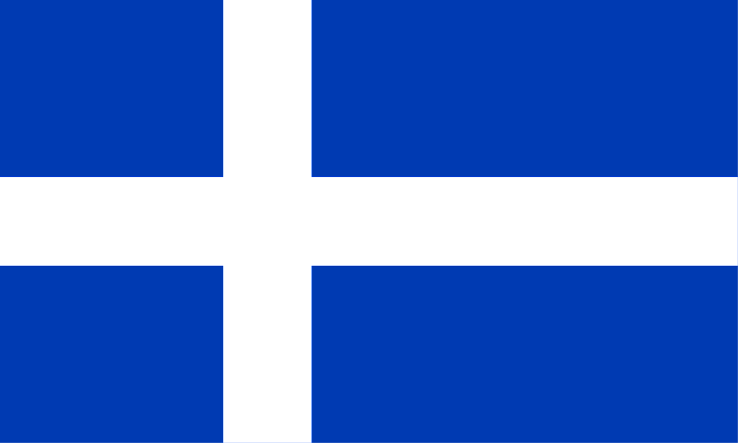
Stone circles and brochs (circular stone towers) furnish evidence of prehistoric settlement, probably by Picts. During the 7th and 8th centuries missionaries began conversion of the population to Christianity. In the 8th and 9th centuries Shetland was invaded by Norsemen, who ruled the islands until the 15th century. The principal language of the islands until the 18th century was Norn, derived from Old Norse, and many Norse customs survive. In 1472 the islands were annexed to the Scottish crown. The islands have nevertheless stood outside the mainstream of Scottish history and traditions. The Shetland flag was designed by Roy Grønneberg and Bill Adams in 1969 to commemorate the 500th anniversary of the transfer of the islands from Norway to the Kingdom of Scotland and the 500 years before as part of Norway. The flag uses the colours of the flag of Scotland, but in the form of the Nordic cross in order to symbolise Shetland's historical and cultural ties with the Nordic region. It is widely used privately by Shetlanders both on land and sea. The flag is now seen as a symbol of the special Shetland identity.
.jpg)
Shetland Flag in Lerwick