
 Menu
MenuSearch the Gazetteer
Are the results not as expected? Modify your search term or change the scope to refine your search.
Results for a place that starts with ...
b
Banffshire, Scotland
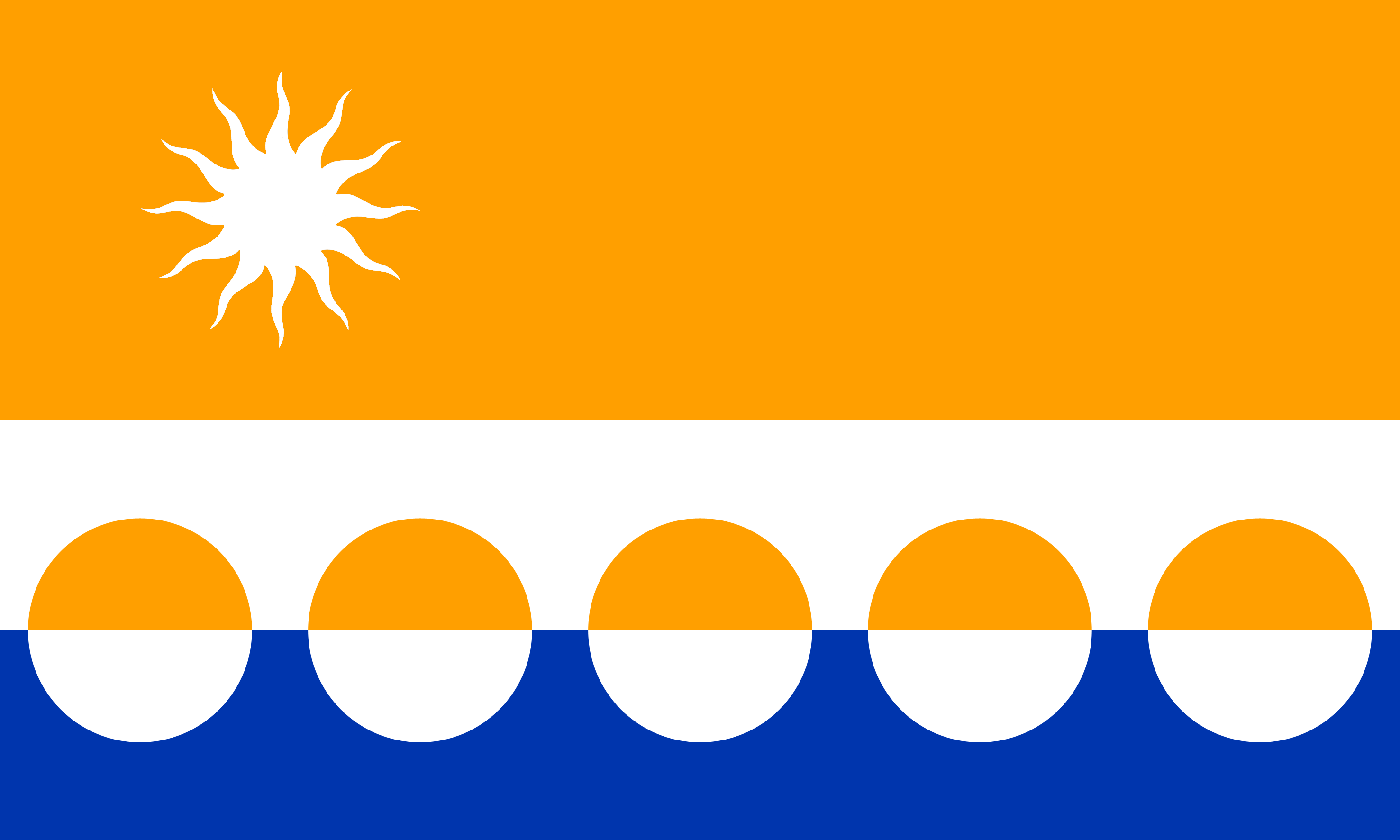 Banffshire is a county on the Moray Firth. The county stretches inland up the valley of the river Spey into the Grampian and Cairngorm mountains. The interior is famed for its whisky production with Glenlivet, Aberlour, Dufftown and Keith hosting famous distilleries. The rugged mountain areas of Banffshire give way further north to more rolling country with fine glens and some areas of rich plains, running down to the coast. Banff itself, standing on Banff Bay, has many historic buildings. Nearby Duff House is one of Scotland's finest classical houses. Across Banff Bay is Macduff. Just outside is the Art Deco, seawater-filled Tarlair lido. The Old Harbour at Portsoy dates to the 17th century. Buckie, based around the 19th-century Cluny Harbour, is the county's biggest town.
 Portrait of Banffshire
Place Type: Historic County
Lat, Long: 57.604382,-2.76708
Grid Reference: NJ 5425 5741
Country: Scotland
GBPN ID: 305774
GGA Code: C01000008
Entry Type: Main listing (P)
URL: https://gazetteer.org.uk/place/Banffshire
 Explore Banffshire on Wikishire
The south of the county is mountainous, but cut through with fertile glens watered by burns and rivers which allow extensive farms. Some of the mountains are thick with forests, some present a beautiful intermixture of rock and copse, while others are covered with brown heath. The greatest mountains are all in the south, where the Cairngorm range is found. Cairn Gorm itself (shared with Inverness-shire) is famous for the amber-coloured quartz crystals found there. The county top is Ben Macdhui (4,296 feet), shared with Aberdeenshire. The River Livet flows north-west across the county here. Glenlivet is known for the Glenlivet Estate and the whisky The Glenlivet.

Ben Macdhui
The northern half of the county is mostly a fine, open, undulating country of rich, highly cultivated soil. Here are found most of the towns and the fishing villages.
Inland, on the River Fiddich, lies Dufftown. It produces more malt whisky than any other town in Scotland, including Glenfiddich, the world's best selling single-malt whisky. Balvenie Castle is a ruined 12th-century castle. On the border (the River Spey) with Morayshire, is Aberlour (fullname Charlestown of Aberlour), home of the famous Aberlour Distillery.

Balvenie Castle
To the north, on the River Isla, is Keith. The town has three distilleries, including Strathisla Distillery, the oldest continuously operating distillery in the Highlands. The Keith and Dufftown Railway is an 11-mile heritage railway running to Dufftown.
Buckie, on the Moray Firth, is the largest town in Banffshire. Once a thriving fishing and shipbuilding port, these industries have declined, though Cluny Harbour remains the heart of the town.
On a headland east of Buckie is Portknockie. The village was founded in 1677 and it became a significant herring fishing port, although today only a handful of commercial inshore boats remain. Green Castle, located on a coastal promontory, is an ancient coastal fort believed to date from 1000 BC and inhabited until AD 1000.
Along the coast to the east is the village of Cullen, noted for Cullen Skink, a traditional soup made from smoked haddock, milk, potato and onion. The village has an impressive beach and golf course, and the Crannoch Wood which offers good views of the area.
The Old Harbour at Portsoy dates to the 17th century and is the oldest on the Moray Firth. Portsoy is known for local jewellery made from "Portsoy marble".

Portsoy Old Harbour
The county town, Banff, stands on Banff Bay. The townscape has many historic buildings, including fragments of the former royal Banff Castle, a pre-Reformation market cross, a fine tolbooth and many vernacular townhouses. Close by is Duff House (HES), designed by William Adam in 1730, and one of Scotland's finest classical houses. On the estate lies the magnificent Bridge of Alvah. Built in 1772, it is a semicircular 'rubble arch' bridge over the Deveron.
.jpg)
Duff House
Macduff also stands on Banff Bay, separated from Banff by the River Deveron. The town has an aquarium, a maritime heritage centre and a golf course (Royal Tarlair). At the base of a sea cliff just outside the town is the Tarlair Swimming Pool. Opened in 1931 and built in Art Deco style, it was closed in the 1990s.

Tarlair Swimming Pool
Bedfordshire, England
 Bedfordshire is an inland county in the southern Midlands. Outside of the main towns, the county comprises rich agricultural land, rolling rural scenery and pretty villages. The north of the county is entirely rural. Bedford itself sits in the centre of the shire on the banks of the Great Ouse. The nearby village of Elstow, birthplace of John Bunyan, has a 15th-century Moot Hall. East of Bedford lie the market towns of Biggleswade and Sandy, both on the River Ivel. The southern end of the county is swept by the chalk ridge of the Chiltern Hills. Luton lies in a break in the Chiltern Hills. Dunstable stands where Watling Street and the Icknield Way cross. Leighton Buzzard is a traditional market town on the River Ouzel. Woburn Abbey is a grand mansion with historic landscaped gardens.
 Portrait of Bedfordshire
Place Type: Historic County
Lat, Long: 52.17418,-0.471142
Grid Reference: TL 0464 5398
Country: England
GBPN ID: 305767
GGA Code: C01000009
Entry Type: Main listing (P)
URL: https://gazetteer.org.uk/place/Bedfordshire
Explore Bedfordshire on WikishireThe county's most famous son, John Bunyan was born in 1628 in the village of Elstow. Although now effectively a southern suburb of Bedford, the original village survives intact including the 15th-century Moot Hall on the village green. The hall is a remarkable survival – an early Tudor-style timber-framed building, built to provide both a courtroom and a market house. The Abbey Church of St Mary and St Helena is the remains of Elstow Abbey, founded c. 1075 by Judith, Countess of Huntingdon, a niece of William the Conqueror.

Moot Hall, Elstow
Bedford itself sits in the centre of the shire on the banks of the Great Ouse. Bedford is a major residential and commercial town. The Embankment is the name given to the gardens lining the Great Ouse as it flows through the town centre. Bedford Castle Mound is the remnant of Bedford's mediæval castle. Bedford Park retains many of its original Victorian features. Bunyan was imprisoned for 12 years in Bedford Gaol, where he wrote The Pilgrim's Progress. The town of Kempston is adjacent to Bedford and serves to some extent as a commuter town for it.
The Cardington Airship Works were founded at Cardington south-east of Bedford by Short Brothers during the First World War. The works were nationalised in 1919 and the R101 was developed here. The two huge airship sheds still dominate the landscape. At Willington, to the east of Bedford, are the 16th-century Willington Dovecote and Stables.

Cardington Airship Hangars
Aside from Bedford itself, the main towns of Bedfordshire lie in its far south. Luton lies in a break in the Eastern part of the Chiltern Hills. The town was for many years famous for hat-making. It is still an industrial town with a major airport. Luton Hoo is a famous country house and estate, much used as a film set, to the south of the town. Nearby too is Someries Castle, a 15th-century fortified manor house.
North of Luton is Houghton Regis, a former village which was expanded as a London overspill estate in the 1950s and 1960s. West of Luton is the market town of Dunstable. Dunstable stands where two ancient routes cross: Watling Street and the Icknield Way. The oldest part of the town is along these routes.
South of the town are the Dunstable Downs, a chalk escarpment forming the north-eastern reaches of the Chiltern Hills. They form the county top. Whipsnade Zoo has cut an enormous lion shape into the chalk in the side of one of the hills. Whipsnade Tree Cathedral (NT) was planted in the 1930s by Edmond Blyth as an act of "Faith, hope and reconciliation" in response to his memories of the First World War.

Whipsnade White Lion
Leighton Buzzard is a traditional market town on the River Ouzel (here the border with Buckinghamshire) at the edge of the Chiltern Hills. Although much developed, the town has managed to retain great charm and character. The Grand Union Canal passes through Leighton Buzzard, its towpaths providing popular walks out into the countryside. The Leighton Buzzard Light Railway is a narrow-gauge heritage railway.
North of these towns, southern Bedfordshire is primarily rural. Woburn Abbey, the seat of the Duke of Bedford, is a grand mansion with historic landscaped gardens, a deer park by Humphry Repton and Woburn Safari Park. Wrest Park (EH), near Flitton, is the family seat of the de Grey family. It is a 19th-century country house with vast gardens from the early 18th century. The de Grey Mausoleum (EH) in Flitton is one of the largest sepulchral chapels in the country. Houghton House (EH), in the historic market town of Ampthill, was built in 1621 by Mary, Countess of Pembroke. It is said to be the model for House Beautiful in Bunyan's The Pilgrim's Progress.

Houghton House
East of Bedford are the market towns of Biggleswade and Sandy. Both lie on the River Ivel. Both lie along the A1 road between London and the North. Sandy is the headquarters of the Royal Society for the Protection of Birds.
North of Bedford, the county is almost entirely rural. The only exception is the far north-east. Here the village of Eaton Socon has been much grown by post-war housing developments. The village lies on the western bank of the Great Ouse, across from St Neots in Huntingdonshire. On Eaton Socon Hill are the remain of Eaton Socon Castle. Bushmead Priory (EH) was established in 1195 as an Augustinian house and, though a ruin, retains mediæval stained glass and wall paintings.

Eaton Socon Castle
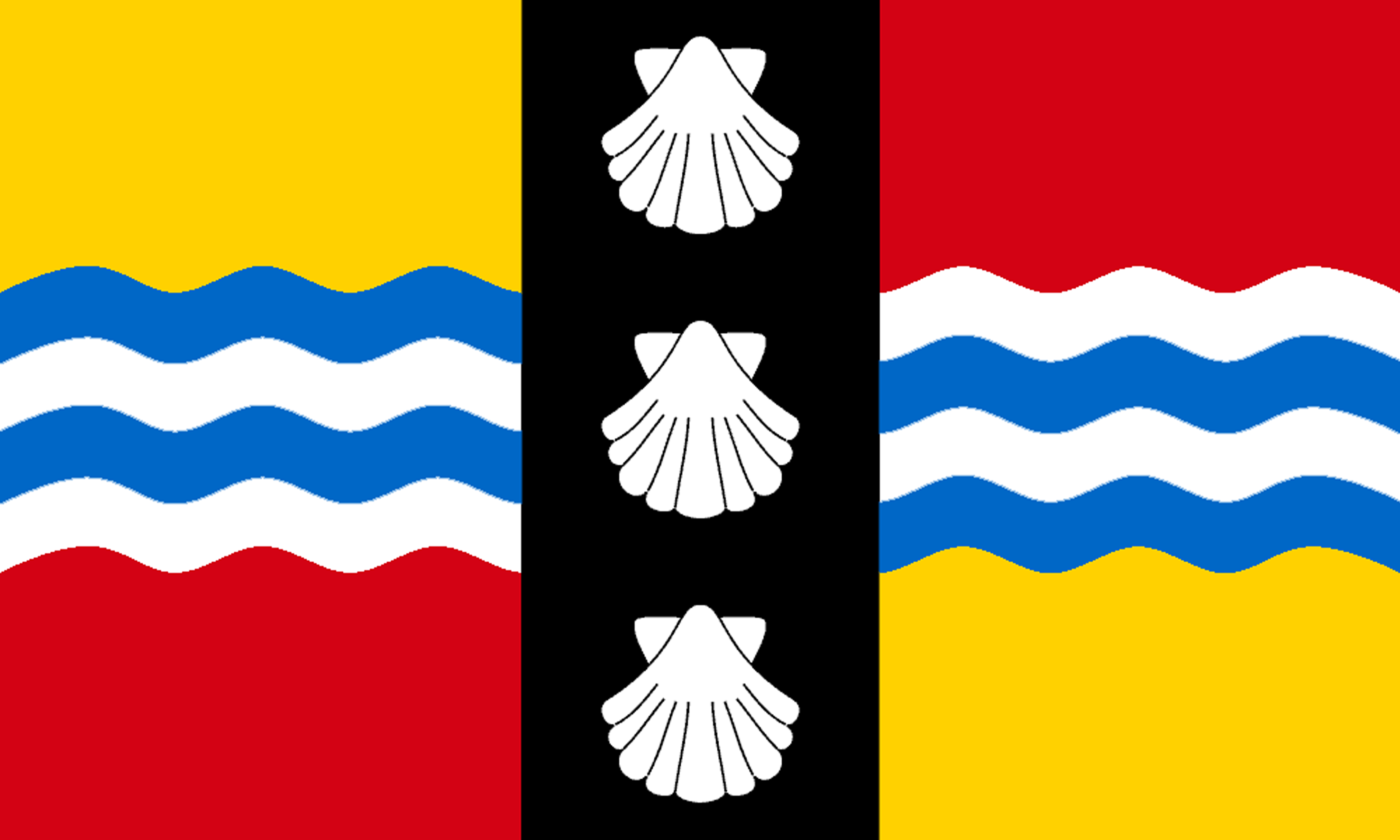
The first recorded use of the name in 1011 was "Bedanfordscir". Bedford itself means "Beda's ford". The Bedfordshire flag comprises red and gold quarters split horizontally by blue and white waves and vertically with a black band containing three white shells. The red and gold quarters are from the arms of the Beauchamps, the leading family in the county after the Norman Conquest. The waves signify the River Great Ouse, and the shells are from the arms of the Russell Family, commemorating their services to the state and to the county. Bedfordshire day is celebrated on 28th November, the birthday of John Bunyan. The Bedfordshire Clanger and Chocolate Toothpaste Tart, famous county dishes, feature prominently in the celebrations.
Berkshire, England
 Berkshire is a Royal County in southern England. The Thames forms the county's entire northern border. The north-west of the county is occupied by the Berkshire Downs along which runs the prehistoric Ridgeway. Between the Downs and the Thames is the Vale of White Horse, overlooked by the famous White Horse of Uffington. Wantage was the birthplace of Alfred the Great. The Shire Hall in Abingdon is a fine example of 17th-century Baroque architecture. The south-west of Berkshire lies in the valley of the Kennet. Newbury has many 17th-century buildings. Reading, with its ruined 12th-century abbey, lies where the Kennet enters the Thames. In the populous east of the county lie Wokingham - an ancient market town; Bracknell - a post-war new town; Sandhurst - known for its military academy; Ascot - famed for its racecourse; Maidenhead - a prosperous Thames-side town; and Windsor - dominated by Windsor Castle.
Portrait of Berkshire
Place Type: Historic County
Lat, Long: 51.561591,-1.408601
Grid Reference: SU 4109 8491
Country: England
GBPN ID: 305815
GGA Code: C01000010
Entry Type: Main listing (P)
URL: https://gazetteer.org.uk/place/Berkshire
Explore Berkshire on WikishireIn the north-west of the county lie the Berkshire Downs, a range of chalk downland hills. Geologically they are continuous with the Marlborough Downs to the west and the Chilterns to the east. They form part of the North Wessex Downs Area of Outstanding Natural Beauty. The downs run east-west from the Wiltshire border, ending close to where the Thames flows south downstream from Wallingford. This south flowing section of the Thames occupies a gap between the Berkshire Downs and the Chilterns, known as the Goring Gap, after Goring on Thames in its centre. The Thames cut this course through the chalk half a million years ago.
Between the Berkshire Downs and the Thames lies the Vale of the White Horse. The Vale is the valley of the Ock, a stream which rises in the Berkshire Downs and flows westward to enter the Thames at Abingdon. The Vale is almost flat and well-wooded; its green meadows and foliage contrasting richly with the bald summits of the Berkshire Downs, which flank it on the south. To the north, a low ridge separates the Vale from the upper Thames Valley. The Vale is dotted with pleasant villages. Wantage, in the heart of the Vale, is famous as the birthplace of King Alfred the Great in 849. The small market town of Faringdon is found in The Vale's north-western rim. Near the town is Buscot Park (NT), an 18th century country house. Great Coxwell Barn (NT) is a large 14th-century stone barn in nearby village of Great Coxwell.

Great Coxwell Barn
The Vale takes its name from the White Horse of Uffington, a huge and mysterious hill figure carved into the chalk hillside above Uffington. The White Horse is 374 feet long and highly stylised. The figure has been dated to the Bronze Age. Many ancient remains occur in the vicinity of the Horse. On the summit of White Horse Hill is Uffington castle, an Iron Age hill fort. To the west lies a long barrow called Wayland's Smithy. A grassy track above the Vale represents the Ridgeway, perhaps five thousand years old. It travels along the crest of the hills, far above what would then have been marshy lowlands or dangerous forests.
The county town of Abingdon lies on the west bank of the Thames, where the Ock flows in the from Vale of the White Horse. The site has been occupied from the early to middle Iron Age and the remains of a late Iron Age defensive enclosure (or oppidum) lies below the town centre. Abingdon Abbey was founded around 676, giving its name to the emerging town. The County Hall, built in 1677–1680, has been hailed as the "grandest town hall in Britain". Abingdon Bridge, crossing the Thames into Oxfordshire, was built in 1416 but often widened and altered. The town of Didcot, five miles south of Abingdon, is noted for its railway heritage and is now a centre for science and technology. Milton Manor House, three miles west of Didcot, is a yellow and red brick manor house built for the Calton family in the 17th century.

The Berkshire County Hall, Abingdon
Wallingford is a beautiful market town at the foot of the Berkshire Downs. The River Thames flows gracefully past, southward toward the Goring Gap. A 900-foot long mediæval stone bridge crosses the river and the adjacent flood plain on the Oxfordshire bank. Wallingford Castle was the last holdout of the Royalists in Berkshire, withstanding a 65-day siege. Oliver Cromwell subsequently ordered the destruction of the castle.

Wallingford Bridge
Several of Oxford's suburbs lie south of the Thames in Berkshire including Grandpont and New Hinksey. More distant suburbs in Berkshire include Cumnor Hill, Botley, Dean Court, Kennington and North Hinksey.
South of the Berkshire Downs runs the valley of the River Kennet. The Kennet has an extensive range of rare plants and animals, unique to chalk watercourses. Fairly steep slopes on each side delineate the river's flat floodplain. To the south, the land rises steeply to the boundary with Hampshire, and here are found the highest parts of the county, the county top is on Walbury Hill. Close by is Hungerford, on the Wiltshire border.
The town of Newbury stands on the River Kennet and the Kennet and Avon Canal, and has a town centre containing many 17th-century buildings. Donnington Castle (EH) is a ruined mediæval castle situated in the village of Donnington just north of Newbury. The nearby small town of Thatcham also stands on the River Kennet and the Kennet and Avon Canal. The Old Bluecoat School was built in 1304 as the Chapel of St Thomas the Martyr. West of Thatcham, from near Aldmasteron Wharf the Kennet flows north-west across the county, flowing in to the Thames at Reading.
Basildon Park (NT) is a country house with a magnificent garden between the villages of Upper Basildon and Lower Basildon.

Rose Garden, Basildon Park
Reading is the largest town of Berkshire. It stands on the River Thames where the River Kennet enters it. Reading is well connected, by the M4 motorway and the Great Western Main Line railway. Reading was an important national centre in the mediæval period, the site of a monastery with strong royal connections. Today it remains a commercial centre, with links to information technology and insurance. It is also a university town with a large student population. Reading Abbey is a large, ruined abbey in the centre of the town. It was founded by Henry I in 1121. In its heyday the abbey was one of Europe's largest royal monasteries.

Reading Abbey
South and west of Reading is the Lodden Valley. The Lodden enters Berkshire near Swallowfield and flows south to north, entering the Thames near Wargrave. The small market town of Wokingham lies on the Emm Brook in the Lodden Valley. The town's formerly important industry, brick-making, has given way to software development, light engineering and service industries. The commuter village of Twyford sits beside the River Loddon as it enters the meadows running down to the River Thames.
Bracknell, in the south-east of the county, was designated a new town in 1949. The town is surrounded, on the east and south, by the vast expanse of Swinley Woods and Crowthorne Woods. South of Bracknell, close to the borders of Hampshire and Surrey, is the small town of Sandhurst, known worldwide as the location of the Royal Military Academy Sandhurst.

Royal Military Academy, Sandhurst
Ascot, close to the Surrey border, is famed as the location of Ascot Racecourse, home of the prestigious Royal Ascot meeting. The racecourse, which is owned by Her Majesty, has shaped the town around itself, as it stands at one end of the High Street and all around are gallops, training grounds, stud farms and shops catering to horsemen and visitors.
North of Ascot, on the Thames, is the suburban town of Windsor. Windsor is the Queen's main residence outside London. This jewel of a town is dominated by Windsor Castle, the largest castle in Britain and indeed the largest inhabited castle in the world. The village of Old Windsor lies on the Thames at the eastern edge of the county. Old Windsor was originally the site of an important palace of the Anglo-Saxon Kings. The Saxon palace was eventually superseded by the Norman Windsor Castle at 'New' Windsor. Windsor Great Park is largely within the bounds of Old Windsor, including both the Royal and Cumberland Lodges.

The Long Walk, Great Windsor Park
Maidenhead is a prosperous town standing on the River Thames, north-west of Windsor. Maidenhead is in England's 'Silicon Corridor' along the M4 motorway. The current Maidenhead Bridge, a local landmark, dates from 1777. King Charles I met his children for the last time before his execution in 1649 at the Greyhound Inn. Bisham Abbey is a 13th-century manor house at nearby Bisham.
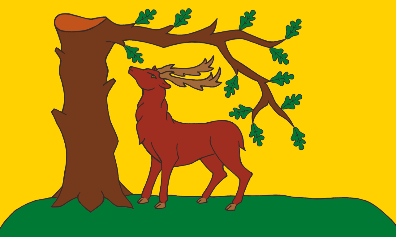
Berkshire is one of the oldest counties in England. The county is first mentioned by name in 860. According to Asser's biography of King Alfred, written in AD 893, its old name Bearrocscir takes its name from a wood of box trees, which was called Bearroc, near Abingdon. The Berkshire flag features a traditional symbol of the county, the stag and oak. This design's connection with the county dates from at least Michael Drayton's 1627 poem Battle of Agincourt, where he describes the men of Berkshire marching under the symbol of "a Stag, under an Oake that stood".
Berwickshire, Scotland
 Berwickshire is a lowland shire, along the border of England and Scotland. Berwickshire can be divided into three areas. In the north-west is Lauderdale - the long, narrow valley of the River Leader. Formerly a forest and a royal hunting ground, Lauderdale is almost completely agricultural. The north of the county lies in the bleak and beauteous landscape of the Lammermuir Hills. Greenlaw, with its impressive town hall, lies in the foothills. The Merse comprises the pastoral lands between the Lammermuirs and the River Tweed, the border with Northumberland. Duns, at its centre, abounds in historic buildings. Coldstream, once a centre for runaway marriages, lies on the Tweed. Sir Walter Scott and Field Marshall Douglas Haig are buried within the grounds of Dryburgh Abbey. The coast consists of high cliffs with sandy coves and picturesque harbours. Eyemouth is a fishing and resort town.
 Portrait of Berwickshire
Place Type: Historic County
Lat, Long: 55.775597,-2.383537
Grid Reference: NT 7603 5365
Country: Scotland
GBPN ID: 305775
GGA Code: C01000011
Entry Type: Main listing (P)
URL: https://gazetteer.org.uk/place/Berwickshire
Explore Berwickshire on WikishireIn the far west of the county is Lauderdale, the long, narrow valley formed by the River Leader. The Roman Road known as Dere Street followed the Leader across the dale, as does the modern A68. There are many ancient camps and tumuli in Lauderdale. Formerly a forest and subsequently a royal hunting ground, today Lauderdale is almost completely agricultural. The royal burgh of Lauder stands in the centre of the dale. Notable buildings include the Tolbooth or Town Hall, which predates 1598. Thirlestane Castle, seat of the Earls of Lauderdale, is set in extensive parklands near the town.
In the north and west of the county is the bleak and beauteous landscape of the Lammermuir Hills. Here lies the county top, Meikle Says Law, on the East Lothian border. The small town of Greenlaw lies in the foothills with its impressive town hall, completed in 1831. Greenknowe Tower (HES) is a 16th-century tower house, located just west of the village of Gordon. Hume Castle is the heavily modified remnants of a late 12th or early 13th century castle of enceinte at the hamlet of Hume.

Greenknowe Tower
The Merse comprises the pastoral lands between the River Tweed to the south and the Lammermuirs to the north and west. It is a richly fertile land, of crops and well-fed livestock, the land level by the rivers and elsewhere undulating and wooded. It is in the Merse that the main towns of Berwickshire are found.
Coldstream stands on the north bank of the Tweed. The town is well known as the home of the Coldstream Guards. The Georgian Coldstream Bridge links Coldstream with Cornhill-on-Tweed in Northumberland. In the 18th and 19th centuries, Coldstream was a popular centre for runaway marriages. Notable buildings include the toll house where marriages were conducted, and The Hirsel, the family seat of the Earls of Home. Paxton House is an 18th-century country house which stands overlooking the River Tweed south-west of Berwick.

The Coldstream Bridge from the Berwickshire bank
The town of Duns lies at the centre of the shire. The town and its environs abound in historic buildings. Duns Law, the original site of the town of Duns, has the remains of an Iron Age hillfort. Duns Castle has a massive Norman Keep or Pele Tower which supposedly dates from 1320. Edin's Hall Broch is a 2nd-century broch near Duns, one of very few brochs found south of the Highlands. Blanerne House is an 18th-century mansion. In its grounds lie the remains of Blanerne Castle, a 16th-century fortified house. Nisbet House is a 17th century mansion based around a 12th-century pele tower. Wedderburn Castle is an 18th-century country house.

Edin's Hall Broch
The Berwickshire coastline consists of high cliffs over deep clear water, with sandy coves and picturesque harbours. Eyemouth is a small fishing town and seaside resort. Notable buildings include Gunsgreen House and a cemetery watch house built to stand guard against the "resurrectionists". Nearby are the attractive small villages of Ayton, Reston, St Abbs, Coldingham, and Burnmouth. The coast offers opportunities for birdwatching, walking, fishing and diving.

St Abbs Head
The village of Cockburnspath lies at the north-east of the county, at the eastern end of the coast-to-coast Southern Uplands Way. Cockburnspath Tower is a ruined 15th-century castle standing above a steep-sided ravine. At the nearby village of Cove is a small fishing harbour and a memorial to the eleven men from Cove who lost their lives in the Eyemouth disaster of 1881.

Cove Harbour
In the far south-west of the county, standing in a loop in the Tweed, stand the ruins of Dryburgh Abbey. Founded in 1150, it was burned twice by the English (in 1322 and 1385), recovering to flourish in the 15th century before being finally destroyed in 1544 during the Rough Wooing. Sir Walter Scott and Field Marshall Douglas Haig are buried in its grounds.
Berwickshire was anciently part of the kingdom of Northumbria until the year 1020 when it was ceded to Malcolm II, King of Scotland, by the Earl of Northumberland. From its situation on the borders, the county was the scene of frequent hostilities and an object of continual dispute between the Scots and the English. The town of Berwick, from which the county is named, might be claimed by Berwickshire but the town was sundered by force from its shire in the mediæval wars, leaving Berwickshire without its natural county town.
Brecknockshire, Wales
Brecknockshire or Breconshire (Sir Frycheiniog) is an inland county in Mid-Wales. Lying on the River Wye, which forms the northern border, are the market town of Builth Wells and the book town of Hay on Wye. The Cambrian mountains lie in the county's north-west. South, in the valley of the River Irfon, is the spa town of Llanwrtyd Wells. The extensive plateau of the Mynydd Epynt lies south of that. The River Usk flows eastwards through the county's central valley. In Brecon are Brecon Cathedral and the Shire Hall. The Usk flows under an elegant 17th-century bridge at Crickhowell. The Brecon Beacons National Park stretches across the south of the county: the Black Mountain range in the west; the former royal hunting ground of Fforest Fawr; the Beacons themselves and, east of the Usk Valley, the Black Mountains. The towns of the land where the Beacons meet the heads of the Valleys - Rassau, Beaufort, Brynmawr, Clydach, Gilwern - were forged by ironmaking. Cefn-coed-y-cmmer is at the head of the Taff Vale. Ystradgynlais lies on the River Tawe, in the shadow of the Black Mountain.
Portrait of Brecknockshire
Place Type: Historic County
Alternative name(s): Breconshire, Sir Frycheiniog
Lat, Long: 51.958746,-3.403187
Grid Reference: SO 0367 2984
Country: Wales
GBPN ID: 305756
GGA Code: C01000012
Entry Type: Main listing (P)
URL: https://gazetteer.org.uk/place/Brecknockshire
Explore Brecknockshire on Wikishire
Brecknockshire's southern border stands along the heads of the South Wales Valleys. Several towns and villages in this area lie in Brecknockshire. The village of Cefn-Coed-y-Cymmer lies north of the Taf Fawr and Taf Fechan, the border with Glamorgan. The impressive Cefn Coed Viaduct, completed in 1866, crosses the Taf Fawr from Brecknockshire into Glamorgan.

Cefn Coed Viaduct
Further east, above the Monmouthshire valleys, lie the villages of Rassau, Carmeltown and Beaufort, the last formed following the establishment of the Beaufort Iron Works in 1779. The market town of Brynmawr grew with the development of the nearby Nantyglo ironworks (in Monmouthshire) in the early 19th century. The Brynmawr Experiment was an effort to address the poverty and unemployment in the town during the 1930s. Among the small industries it spawned was the Brynmawr Furniture Makers Ltd. The Market Hall Cinema is claimed to be the longest continually running cinema in Wales.
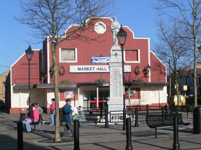
Brynmawr War Memorial and Market Hall
Across the south of the county are three mountain ranges. All three ranges form part of the Brecon Beacons National Park. In the south-west, the Black Mountain range straddles into Brecknockshire from Carmarthenshire. The highest point is Fan Brycheiniog (2,631ft). South of the Black Mountain, on the River Tawe, lies Ystradgynlais. The town grew around the iron-making, coal-mining and watch-making industries.

Fan Brycheiniog
To the east of the Black Mountain range is Fforest Fawr or the Great Forest of Brecknock, a former royal hunting area. There are several peaks over 2,000ft including Fan Fawr (2,408ft). Within Fforest Fawr are the spectacular Henrhyd Falls and the Dan-yr-Ogof showcaves.

Henrhyd Falls
East of the Merthyr to Brecon road (A470), stretch the Brecon Beacons, including the county top Pen y Fan (2,900 feet). Other notable summits include Corn Du (2,864 feet), Cribyn (2,608 feet), and Fan y Big (2,359 feet). These summits form a long ridge which forms a horseshoe around the head of the Taf Fechan. Llangorse Lake, the county’s largest natural lake, lies deep with the Brecon Beacons. The lake is famed in folklore and home to an “afanc” (lake monster) nicknamed ‘Gorsey’.

Llangorse Lake from Allt yr Esgair
The central part of the county is dominated by the valley of the great River Usk. The Usk rises in the Black Mountain range, forming the border with Cardiganshire before turning east into Brecknockshire. A great diversity of plants and animal life dwell in and along the Usk.
The Usk flows south of the village of Trecastle, named after its 11th-century Norman motte-and-bailey fortification. On the summit of Trecastle Mountain is 'Y Pigwn', two overlaying Roman practice marching camps. There are also two stone circles. At the village of Sennybridge the Usk is joined by the Afon Senni.

Trecastle Mountain stone circle
Y Gaer (Cadw) is a Roman fort built around AD 75, sitting on a crossroads of Roman roads in the Usk valley. It was manned by highly trained legionaries of the Vettonian Spanish Cavalry Regiment. Now in quiet countryside, in Roman times this was a busy site, with a large guardhouse, granary and heated bathhouse.

Brecon Castle
The county town, Brecon, lies where the Usk is joined by the Honddu. The confluence of the rivers made for a valuable defensive position for the Norman castle which overlooks the town. North of the castle stands Brecon Cathedral, built on the orders of Bernard de Neufmarché, the Norman conquerer of Brycheiniog. The Usk Bridge, which carries the B4601 over the river, was built in 1563 and painted by Turner c.1769. The Brecknockshire Shire Hall, opened in 1842, houses the county museum and its remarkable Victorian court room. The town has a long association with the military and houses the Regimental Museum of the Royal Welsh. Theatr Brycheiniog is located on Canal Wharf, alongside the Monmouthshire and Brecon Canal, which runs from Brecon for 35 miles to Pontymoile in Monmouthshire. The Brecon Jazz Festival is held each year in August.

Brecknockshire Shire Hall
After Brecon, the Usk heads south-east to the small town of Crickhowell. The Usk is bridged here by an elegant 17th-century stone bridge. Also within the town are the 14th-century parish church of St Edmund, and the ruins of Crickhowell Castle.

Crickhowell Castle
North of Crickhowell are the ruins of Tretower Castle (Cadw). The castle was founded as a motte and bailey castle by Picard, a follower of Bernard de Neufmarche, with a stone shell and tower added later. In the early 14th century residential buildings were constructed away from the original fortifications forming Tretower Court (Cadw). Over time the lords of Tretower favoured the more luxurious Court and the castle fell into disuse.
Tretower Court
South of Crickhowell, in the Usk valley, lies the village of Gilwern, once an important industrial centre due to its location beside the Monmouthshire and Brecon canal. To the west, the River Clydach rises on Llangattock Mountain and flows south-east through the spectacular Clydach Gorge before joining the Usk at Gilwern. The village of Clydach was the site of a major ironworks. The Usk leaves Brecknockshire and heads into Monmouthshire just south of Gilwern.

Clydach Gorge ironworks
To the east of the Usk Valley lie the Black Mountains (not to be confused with the Black Mountain range). These cross over into Monmouthshire and Herefordshire, though the highest mountain Waun Fach (2,661 feet) is in Brecknockshire. The peak and ridge of Black Mountain (2,306 feet) forms the Brecknockshire – Herefordshire border, the summit forming the county top of Herefordshire.

View from Lord Hereford's Knob in the Black Mountains
North of the Usk Valley is an upland plateau known as the Mynydd Epynt. To the north of that, the valley of the River Irfon flows from west to east across the county, joining the Wye at Builth Wells. Llanwrtyd Wells developed as a spa town following the discovery in 1732, by the Rev Theophilus Evans, of waters claimed to have amazing healing properties.

Bridge over River Irfon at Llanwrtyd Wells
In the north-west of the county lie the Cambrian Mountains. The River Wye forms the Radnorshire border from south of Rhayader. The ford of the Wye at Builth Wells was the main north-south route in Wales. The bridge over the A470 still performs this role. Builth Castle was built under Edward I. The only remains are huge earthworks. The town added "Wells" in the 19th century when its springs were promoted as a visitor attraction.

The Wye Bridge at Builth Wells. Brecknockshire is on the right bank and Radnorshire on the left bank
The small town of Talgarth lies between the Wye and the Black Mountains. Notable buildings include its 14th-century parish church and a 13th-century pele tower. Nearby Bronllys Castle (Cadw) is a motte and bailey fortress first constructed around 1100.

Bronllys Castle keep
Just east of the town of Hay-on-Wye, the Dulas Brook flows into the Wye at the point where Brecknockshire, Radnorshire and Herefordshire meet. Hay-on-Wye is famous for its large number of second-hand bookshops, describing itself as "The Towns of Books". The Hay Festival has become a prominent festival in British culture.

Butter Market, Hay-on-Wye
Brycheiniog was an independent kingdom in the Early Middle Ages. The exact origins of Brycheiniog are unclear but the name is thought to derive from Brychan mac Anlach, the 5th-century ruler of the area. Over the succeeding centuries many dynasties ruled the kingdom, alliances were made and broken, victories won and defeats suffered, but the kingdom maintained its integrity and identity up to Norman times. Bernard de Neufmarché was a minor Norman lord who successfully undertook the conquest of the Kingdom of Brycheiniog between 1088 and 1095. Bernard established a Marcher Lordship in its place – the Lordship of Brecknock. By the early Tudor period, the lordship was ruled by the Earls of Buckingham. When Edward Stafford, 3rd Duke of Buckingham, was executed for treason, the Lordship was forfeited to the crown. Henry VIII combined it with the cantref of Buellt. By the Laws in Wales Acts 1535, Henry VIII converted the combined territory into the county of Brecknock.

The Brecknockshire flag at the county border
Brecknockshire does not currently have a county flag registered with the Flag Institute. The proposed Brecknockshire flag is derived from the arms assigned to Brychan in the later mediæval period and later informally adopted by Brecknockshire County Council.
Portrait of Brecknockshire
Place Type: Historic County
Alternative name(s): Breconshire, Sir Frycheiniog
Lat, Long: 51.958746,-3.403187
Grid Reference: SO 0367 2984
Country: Wales
GBPN ID: 305756
GGA Code: C01000012
Entry Type: Main listing (P)
URL: https://gazetteer.org.uk/place/Brecknockshire
Explore Brecknockshire on WikishireBrecknockshire's southern border stands along the heads of the South Wales Valleys. Several towns and villages in this area lie in Brecknockshire. The village of Cefn-Coed-y-Cymmer lies north of the Taf Fawr and Taf Fechan, the border with Glamorgan. The impressive Cefn Coed Viaduct, completed in 1866, crosses the Taf Fawr from Brecknockshire into Glamorgan.

Cefn Coed Viaduct
Further east, above the Monmouthshire valleys, lie the villages of Rassau, Carmeltown and Beaufort, the last formed following the establishment of the Beaufort Iron Works in 1779. The market town of Brynmawr grew with the development of the nearby Nantyglo ironworks (in Monmouthshire) in the early 19th century. The Brynmawr Experiment was an effort to address the poverty and unemployment in the town during the 1930s. Among the small industries it spawned was the Brynmawr Furniture Makers Ltd. The Market Hall Cinema is claimed to be the longest continually running cinema in Wales.

Brynmawr War Memorial and Market Hall
Across the south of the county are three mountain ranges. All three ranges form part of the Brecon Beacons National Park. In the south-west, the Black Mountain range straddles into Brecknockshire from Carmarthenshire. The highest point is Fan Brycheiniog (2,631ft). South of the Black Mountain, on the River Tawe, lies Ystradgynlais. The town grew around the iron-making, coal-mining and watch-making industries.

Fan Brycheiniog
To the east of the Black Mountain range is Fforest Fawr or the Great Forest of Brecknock, a former royal hunting area. There are several peaks over 2,000ft including Fan Fawr (2,408ft). Within Fforest Fawr are the spectacular Henrhyd Falls and the Dan-yr-Ogof showcaves.
.jpg)
Henrhyd Falls
East of the Merthyr to Brecon road (A470), stretch the Brecon Beacons, including the county top Pen y Fan (2,900 feet). Other notable summits include Corn Du (2,864 feet), Cribyn (2,608 feet), and Fan y Big (2,359 feet). These summits form a long ridge which forms a horseshoe around the head of the Taf Fechan. Llangorse Lake, the county’s largest natural lake, lies deep with the Brecon Beacons. The lake is famed in folklore and home to an “afanc” (lake monster) nicknamed ‘Gorsey’.

Llangorse Lake from Allt yr Esgair
The central part of the county is dominated by the valley of the great River Usk. The Usk rises in the Black Mountain range, forming the border with Cardiganshire before turning east into Brecknockshire. A great diversity of plants and animal life dwell in and along the Usk.
The Usk flows south of the village of Trecastle, named after its 11th-century Norman motte-and-bailey fortification. On the summit of Trecastle Mountain is 'Y Pigwn', two overlaying Roman practice marching camps. There are also two stone circles. At the village of Sennybridge the Usk is joined by the Afon Senni.

Trecastle Mountain stone circle
Y Gaer (Cadw) is a Roman fort built around AD 75, sitting on a crossroads of Roman roads in the Usk valley. It was manned by highly trained legionaries of the Vettonian Spanish Cavalry Regiment. Now in quiet countryside, in Roman times this was a busy site, with a large guardhouse, granary and heated bathhouse.
.jpg)
Brecon Castle
The county town, Brecon, lies where the Usk is joined by the Honddu. The confluence of the rivers made for a valuable defensive position for the Norman castle which overlooks the town. North of the castle stands Brecon Cathedral, built on the orders of Bernard de Neufmarché, the Norman conquerer of Brycheiniog. The Usk Bridge, which carries the B4601 over the river, was built in 1563 and painted by Turner c.1769. The Brecknockshire Shire Hall, opened in 1842, houses the county museum and its remarkable Victorian court room. The town has a long association with the military and houses the Regimental Museum of the Royal Welsh. Theatr Brycheiniog is located on Canal Wharf, alongside the Monmouthshire and Brecon Canal, which runs from Brecon for 35 miles to Pontymoile in Monmouthshire. The Brecon Jazz Festival is held each year in August.

Brecknockshire Shire Hall
After Brecon, the Usk heads south-east to the small town of Crickhowell. The Usk is bridged here by an elegant 17th-century stone bridge. Also within the town are the 14th-century parish church of St Edmund, and the ruins of Crickhowell Castle.

Crickhowell Castle
North of Crickhowell are the ruins of Tretower Castle (Cadw). The castle was founded as a motte and bailey castle by Picard, a follower of Bernard de Neufmarche, with a stone shell and tower added later. In the early 14th century residential buildings were constructed away from the original fortifications forming Tretower Court (Cadw). Over time the lords of Tretower favoured the more luxurious Court and the castle fell into disuse.

Tretower Court
South of Crickhowell, in the Usk valley, lies the village of Gilwern, once an important industrial centre due to its location beside the Monmouthshire and Brecon canal. To the west, the River Clydach rises on Llangattock Mountain and flows south-east through the spectacular Clydach Gorge before joining the Usk at Gilwern. The village of Clydach was the site of a major ironworks. The Usk leaves Brecknockshire and heads into Monmouthshire just south of Gilwern.

Clydach Gorge ironworks
To the east of the Usk Valley lie the Black Mountains (not to be confused with the Black Mountain range). These cross over into Monmouthshire and Herefordshire, though the highest mountain Waun Fach (2,661 feet) is in Brecknockshire. The peak and ridge of Black Mountain (2,306 feet) forms the Brecknockshire – Herefordshire border, the summit forming the county top of Herefordshire.

View from Lord Hereford's Knob in the Black Mountains
North of the Usk Valley is an upland plateau known as the Mynydd Epynt. To the north of that, the valley of the River Irfon flows from west to east across the county, joining the Wye at Builth Wells. Llanwrtyd Wells developed as a spa town following the discovery in 1732, by the Rev Theophilus Evans, of waters claimed to have amazing healing properties.

Bridge over River Irfon at Llanwrtyd Wells
In the north-west of the county lie the Cambrian Mountains. The River Wye forms the Radnorshire border from south of Rhayader. The ford of the Wye at Builth Wells was the main north-south route in Wales. The bridge over the A470 still performs this role. Builth Castle was built under Edward I. The only remains are huge earthworks. The town added "Wells" in the 19th century when its springs were promoted as a visitor attraction.
.jpg)
The Wye Bridge at Builth Wells. Brecknockshire is on the right bank and Radnorshire on the left bank
The small town of Talgarth lies between the Wye and the Black Mountains. Notable buildings include its 14th-century parish church and a 13th-century pele tower. Nearby Bronllys Castle (Cadw) is a motte and bailey fortress first constructed around 1100.

Bronllys Castle keep
Just east of the town of Hay-on-Wye, the Dulas Brook flows into the Wye at the point where Brecknockshire, Radnorshire and Herefordshire meet. Hay-on-Wye is famous for its large number of second-hand bookshops, describing itself as "The Towns of Books". The Hay Festival has become a prominent festival in British culture.

Butter Market, Hay-on-Wye
Brycheiniog was an independent kingdom in the Early Middle Ages. The exact origins of Brycheiniog are unclear but the name is thought to derive from Brychan mac Anlach, the 5th-century ruler of the area. Over the succeeding centuries many dynasties ruled the kingdom, alliances were made and broken, victories won and defeats suffered, but the kingdom maintained its integrity and identity up to Norman times. Bernard de Neufmarché was a minor Norman lord who successfully undertook the conquest of the Kingdom of Brycheiniog between 1088 and 1095. Bernard established a Marcher Lordship in its place – the Lordship of Brecknock. By the early Tudor period, the lordship was ruled by the Earls of Buckingham. When Edward Stafford, 3rd Duke of Buckingham, was executed for treason, the Lordship was forfeited to the crown. Henry VIII combined it with the cantref of Buellt. By the Laws in Wales Acts 1535, Henry VIII converted the combined territory into the county of Brecknock.

The Brecknockshire flag at the county border
Brecknockshire does not currently have a county flag registered with the Flag Institute. The proposed Brecknockshire flag is derived from the arms assigned to Brychan in the later mediæval period and later informally adopted by Brecknockshire County Council.
Buckinghamshire, England
 Buckinghamshire is an inland county in the south of England. The Thames forms the southern border. On it are the pretty riverside villages of Datchet, Eton and Taplow. Slough and its suburbs form a major urban area. To its north lies the semi-ancient woodland of Burnham Beeches. Gerrards Cross and Beaconsfield lie north of the beeches. North of these, the delightful Chiltern Hills sweep north-westward across the county, with beech woods in the west, rising to higher, more windswept landscape around Ivinghoe Beacon, and all full of pretty villages of flint and thatch. The market towns of Amersham and High Wycombe lie amongst the Chiltern Hills. The Vale of Aylesbury is a large area of flat land in the middle of the county. Aylesbury has been a market town since Saxon times. Buckingham has a historic marketplace. In the county's north-east lies Milton Keynes, a 1960s new town. Bletchley was the location of Britain's wartime codebreaking activities. In the far north-east is Olney, famous for its ancient Pancake Race.
Portrait of Buckinghamshire
Place Type: Historic County
Lat, Long: 51.843136,-0.836573
Grid Reference: SP 8024 1669
Country: England
GBPN ID: 305816
GGA Code: C01000013
Entry Type: Main listing (P)
URL: https://gazetteer.org.uk/place/Buckinghamshire
Explore Buckinghamshire on WikishireThe Thames forms Buckinghamshire's southern border with Surrey and Berkshire. On its banks are several pretty riverside villages, amongst them Datchet, Eton (home to the famous school) and Taplow. Cliveden (NT) is an Italianate mansion set on the banks of the River Thames at Taplow. As home of Nancy Astor, the house was the meeting place of the Cliveden set of the 1930s. The prosperous town of Marlow lies further upstream. Marlow Rowing Club, founded in 1871, is one of Britain's premier rowing clubs.

Cliveden
The town of Slough and its suburbs form a major urban area in the south-east of the county. Once a small village, the establishment of the Slough Trading Estate in the 1920s led to spectacular growth. Many of the original villages of the area are now urban districts of Slough. The villages of Chalvey, Langley and Upton have become suburbs. North of Slough lie Burnham Beeches, a 900-acre semi-ancient beech forest, much used a location by the film industry.
The town of Gerrards Cross and the nearby village of Chalfont St Peter lie close to the Hertfordshire border. Bulstrode is an English country house and its large park. The estate spreads across Chalfont St Peter and Gerrard's Cross and predates the Norman conquest.
Beaconsfield is a prosperous market town with two centres; the historic heart on the old London road and the New Town built around the railway station.
To the north of Beaconsfield and Gerrard's Cross, the delightful Chiltern Hills sweep north-westward across the county. They give the shire much of its character; with beech woods in the west, rising to higher, more windswept landscape around Ivinghoe Beacon, and all full of pretty villages of flint and thatch. It provides fine walking country.
Ivinghoe Beacon
The market town of High Wycombe lies in the valley of the River Wye surrounded by the Chiltern Hills. Hughenden Manor (NT), a red brick Victorian mansion near the town, was the country house of Benjamin Disraeli. West Wycombe Park (NT) is a grand country house near West Wycombe, conceived as a pleasure palace for the 18th-century libertine and dilettante Sir Francis Dashwood.
The market towns of Amersham and Chesham lies amongst the Chiltern Hills. Amersham's broad High Street is lined with Georgian buildings and the Market Hall, built in 1682. The Chilterns village of Bradenham is renowned for its beauty in a beautiful setting, and to preserve it the whole village has been owned by the National Trust since 1956. Halton House is a country house built for Alfred Freiherr de Rothschild between 1880 and 1883. It is used as the officers' mess for RAF Halton.

The Market Hall, Amersham
The boundary of the Chiltern Hills is clearly defined on the north-west side by the scarp slope. The small market town of Wendover sits in a gap in this scarp. The Wendover Woods roll over the countryside. Haddington Hill (876 feet) is Buckinghamshire's county top.
Princes Risborough sits sheltered beneath the scarp slope of the Chilterns. Princes Risborough Manor House (NT) is an elegant 17th-century house. The town is overlooked by the Whiteleaf Cross, carved in the chalk of the hillside. North from here the land flattens out into the Vale of Aylesbury.
The Vale of Aylesbury is a large area of flat land in the midst of Buckinghamshire. The Vale is drained by the River Thame and its tributaries. The Vale has fine agricultural land.
The county town of Aylesbury had been a major market town since Anglo-Saxon times. The Buckinghamshire County Museum is housed in Ceely House. The Aylesbury Duck is a local speciality. The pioneering rehabilitation work carried by Sir Ludwig Guttmann at Stoke Mandeville Hospital led to the development of the Paralympic Games. Outside the town are Chequers, the Prime Minister's country residence; the 17th-century Hartwell House (NT); and Waddesdon Manor (NT), a grand country house built in the Neo-Renaissance style of a French château for Baron Ferdinand de Rothschild.
Winslow is a small market town in the Vale, 30 miles north-west of Aylesbury. Winslow Hall was built possibly from the designs of Sir Christopher Wren by William Lowndes, secretary to the Treasury. His name and the date 1700 can be seen over the door. Nearby is Claydon House (NT), a 18th-century country house.
Buckingham, in the north-west of the Vale, is a bustling small market town. Its heart is its historic market place. Buckingham Chantry Chapel (NT) is a 15th-century chapel. Nearby Stowe House is a grand country house which is now school. Stowe Landscape Gardens (NT) are a significant example of the English garden style.
.jpg)
Stowe Landscape Gardens
Brill Windmill, in the west of the Vale, is one of the most ancient post mills in the country. In the nearby village of Boarstall are Boarstall Tower, a 14th-century moated gatehouse, and the 17th century Boarstall Duck Decoy (NT), one of the few working decoys in Britain.
The small town of Linslade lies on west bank of the River Ouzel, the border with Bedfordshire. Across the border is Leighton Buzzard. South of the town, Mentmore Towers has been described as one of the greatest houses of the Victorian era.
In the north-east of the county lies Milton Keynes, developed as a new town from the 1960s. Its area incorporated three existing towns, fifteen villages and the farmland in between. The villages have become districts within the town. The three towns have maintained a distinct identity. Bletchley is best known for Bletchley Park, the headquarters of Britain's Second World War codebreaking organisation, now a museum. Stony Stratford stands on Watling Street where the Great Ouse divides Buckinghamshire from Northamptonshire. Wolverton lies south of an earlier settlement, known as Old Wolverton which is a deserted village with a motte and bailey castle.

Block B, Bletchley Park
Newport Pagnell lies north of Milton Keynes. Tickford Bridge, over the River Ouzel, was built in 1810 and is the only iron bridge in Britain that still carries main road traffic. Nearby Chicheley Hall is an 18th-century country house built in the Baroque style.

Tickford Bridge
The market town of Olney, in the county's far north-east, is famous for the Olney Pancake Race which dates to 1455. Every Shrove Tuesday, the women of Olney run from the market place to the Church of St Peter and St Paul, a distance of about 416 yards. The traditional prize is a kiss from the verger.
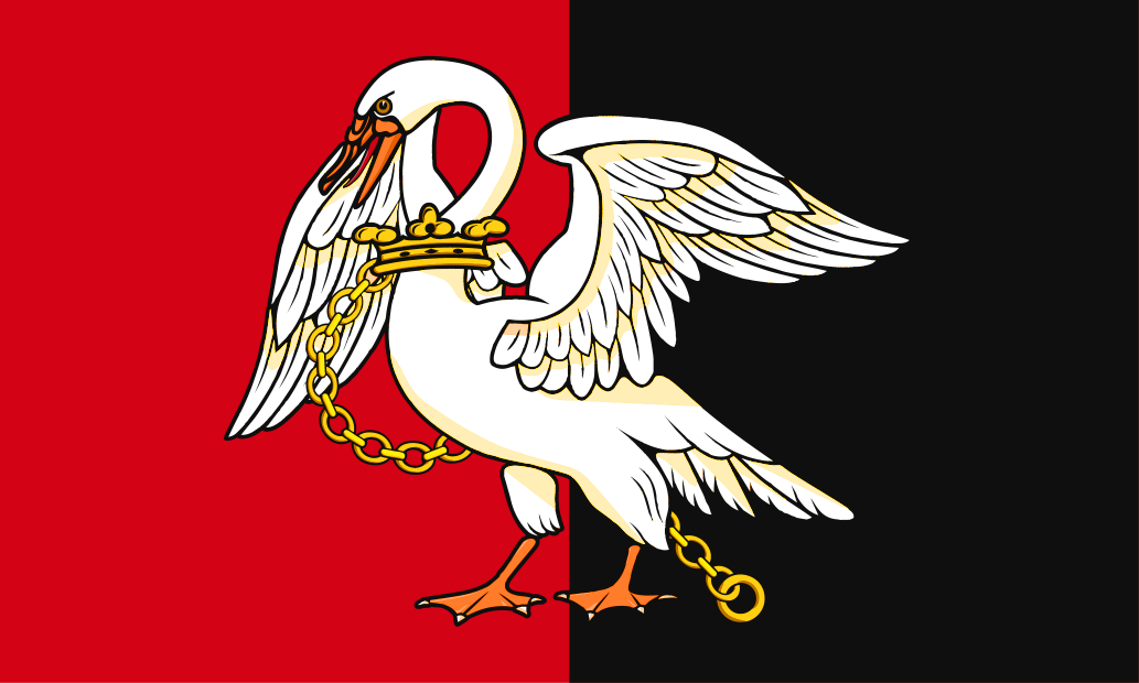
Buckinghamshire takes its name from its original county town, Buckingham, whose name in turn is form the Old English Buccingaham ("Bucca's kin's home"). Buckinghamshire first appears in the Anglo-Saxon Chronicle (as Buccingahamscir) in 1010. The traditional flag of Buckinghamshire features a chained swan on a bicolour of red and black. The swan emblem dates back to Anglo-Saxon times, when Buckinghamshire was known for breeding swans for the king. The flag has been in use for centuries. Buckinghamshire Day is celebrated annually on July 29th, chosen to commemorate the first ever Stoke Mandeville Games in 1948. The Games, originally held for servicemen who had suffered injuries, became the precursors of the Paralympic Games.
Buteshire, Scotland
Buteshire is a county made of islands in the Firth of Clyde. The Isle of Bute stands just off the Cowal peninsula of Argyllshire. On the east coast is the wee port of Rothesay and Mount Stuart House, ancestral home of the Marquesses of Bute, an impressive neo-Gothic mansion. The west coast of Bute is known for its beaches. Southward of Bute is the Isle of Arran, a mountainous island, full of wild, beautiful scenery, but sparsely populated. There are numerous Neolithic remains, including six stone circles on Machrie Moor. Holy Isle, lying inside Lamlash Bay on Arran, has a long history as a sacred site with a Holy well and the cave of 6th-century hermit St Molaise. Great Cumbrae lies east of Bute. Millport, its only town, lies on its southern coast. On Little Cumbrae, a rough and rocky island, is the Cumbrae Lighthouse (1793).
Portrait of Buteshire
Place Type: Historic County
Lat, Long: 55.832274,-5.095609
Grid Reference: NS 0622 6422
Country: Scotland
GBPN ID: 305776
GGA Code: C01000014
Entry Type: Main listing (P)
URL: https://gazetteer.org.uk/place/Buteshire
Explore Buteshire on Wikishire
The Isle of Bute stands just off the Cowal peninsula of Argyll. Its main town is the wee port of Rothesay on its east coast. The western side of Bute is known for its beaches, many of which enjoy fine views over the Sound of Bute towards the Isle of Arran. The northern part of the island is sparsely populated. The eccentric Mount Stuart House is often cited as one the world's most impressive neo-Gothic mansions. Rothesay Castle was built 800 years ago by the hereditary High Steward of Scotland. Scalpsie Bay has a colony of over 200 seals. The island also has many herds of deer, rich bird life and some large hares. Wild goats with large curled horns may be seen in the north of the island. Farming and tourism are the main industries, along with fishing and forestry.

Mount Stuart House, Isle of Bute
The Isle of Arran lies southward of the Isle of Bute. Arran is a mountainous island, full of wild, beautiful scenery, but sparsely populated. The main industry is tourism. Arran's villages are mainly found around the shoreline. Brodick is the site of the ferry terminal, several hotels, and the majority of shops. Brodick Castle (NTS) is a seat of the Dukes of Hamilton. Lamlash is the largest village on the island. Arran has a particular concentration of early Neolithic Clyde Cairns, a form of Gallery grave. There are numerous standing stones dating from prehistoric times, including six stone circles on Machrie Moor. Arran is a paradise for nature lovers. Over 200 species of bird have been recorded including black guillemot, eider duck and golden eagle. Red deer are numerous on the northern hills, and there are populations of red squirrel, badger, otter, adder and common lizard. Offshore there are harbour porpoises, basking sharks and various species of dolphin. The island has three endemic species of tree, the Arran Whitebeams.

Machrie Moor stone circles
Holy Isle is a small island lying inside Lamlash Bay on the Isle of Arran. The island has a long history as a sacred site, with a spring or Holy well held to have healing properties, the hermit cave of 6th-century monk St Molaise, and evidence of a 13th-century monastery. It is now a religious retreat and a nature reserve.

Holy Isle from Lamlash Bay on Arran
Great Cumbrae lies to its east of Arran, off the Ayrshire coast. Great Crumbrae is 2.4 miles long by 1.4 miles wide, rising to a height of 417 feet at "The Glaidstone" - a large, naturally occurring rock perched on the highest summit on the island. Millport, the island's only town, is spread around a bay which makes up the entire south coast of the island.
Little Cumbrae, half a mile south of Great Cumbrae, is a rough and rocky island. The island is privately owned. Cumbrae Lighthouse was built in 1793 and lies on a broad raised beach on the western shore of the island looking out into the Firth.
Millport, Great Cumbrae with Little Cumbrae in the distance
Buteshire was created around 1388 when a heritable sheriff was first appointed to the islands. Prior to that they had formed part of Kintyre district of Argyllshire.
Portrait of Buteshire
Place Type: Historic County
Lat, Long: 55.832274,-5.095609
Grid Reference: NS 0622 6422
Country: Scotland
GBPN ID: 305776
GGA Code: C01000014
Entry Type: Main listing (P)
URL: https://gazetteer.org.uk/place/Buteshire
Explore Buteshire on WikishireThe Isle of Bute stands just off the Cowal peninsula of Argyll. Its main town is the wee port of Rothesay on its east coast. The western side of Bute is known for its beaches, many of which enjoy fine views over the Sound of Bute towards the Isle of Arran. The northern part of the island is sparsely populated. The eccentric Mount Stuart House is often cited as one the world's most impressive neo-Gothic mansions. Rothesay Castle was built 800 years ago by the hereditary High Steward of Scotland. Scalpsie Bay has a colony of over 200 seals. The island also has many herds of deer, rich bird life and some large hares. Wild goats with large curled horns may be seen in the north of the island. Farming and tourism are the main industries, along with fishing and forestry.

Mount Stuart House, Isle of Bute
The Isle of Arran lies southward of the Isle of Bute. Arran is a mountainous island, full of wild, beautiful scenery, but sparsely populated. The main industry is tourism. Arran's villages are mainly found around the shoreline. Brodick is the site of the ferry terminal, several hotels, and the majority of shops. Brodick Castle (NTS) is a seat of the Dukes of Hamilton. Lamlash is the largest village on the island. Arran has a particular concentration of early Neolithic Clyde Cairns, a form of Gallery grave. There are numerous standing stones dating from prehistoric times, including six stone circles on Machrie Moor. Arran is a paradise for nature lovers. Over 200 species of bird have been recorded including black guillemot, eider duck and golden eagle. Red deer are numerous on the northern hills, and there are populations of red squirrel, badger, otter, adder and common lizard. Offshore there are harbour porpoises, basking sharks and various species of dolphin. The island has three endemic species of tree, the Arran Whitebeams.

Machrie Moor stone circles
Holy Isle is a small island lying inside Lamlash Bay on the Isle of Arran. The island has a long history as a sacred site, with a spring or Holy well held to have healing properties, the hermit cave of 6th-century monk St Molaise, and evidence of a 13th-century monastery. It is now a religious retreat and a nature reserve.

Holy Isle from Lamlash Bay on Arran
Great Cumbrae lies to its east of Arran, off the Ayrshire coast. Great Crumbrae is 2.4 miles long by 1.4 miles wide, rising to a height of 417 feet at "The Glaidstone" - a large, naturally occurring rock perched on the highest summit on the island. Millport, the island's only town, is spread around a bay which makes up the entire south coast of the island.
Little Cumbrae, half a mile south of Great Cumbrae, is a rough and rocky island. The island is privately owned. Cumbrae Lighthouse was built in 1793 and lies on a broad raised beach on the western shore of the island looking out into the Firth.

Millport, Great Cumbrae with Little Cumbrae in the distance
Buteshire was created around 1388 when a heritable sheriff was first appointed to the islands. Prior to that they had formed part of Kintyre district of Argyllshire.