
 Menu
MenuSearch the Gazetteer
Are the results not as expected? Modify your search term or change the scope to refine your search.
Results for a place that exactly matches ...
Sutherland
Sutherland, Scotland
 Sutherland is a maritime county, stretching across the north end of Scotland from the Atlantic to the North Sea. It is a Highland county, rough with mountain and moor. The north coast is a mixture of sandy bays and crags. There are two deep sea lochs, the Kyle of Tongue and Loch Eriboll. Coastal villages include Durness and Tongue. Beyond Loch Durness is the great rock of Cape Wrath, where the coast turns round to head south. This west coast is rocky and rough and sparingly inhabited. Coastal villages include Lochinver, Scourie and Kinlockbervie. Sutherland's North Sea coast is smoother, running from the Dornoch Firth to a little beyond Helmsdale. Dornoch is a seaside resort with the 13th-century Dornoch Cathedral. Bonar Bridge lies on the Kyle of Sutherland. The interior of Sutherland is high and bleak. There are lochs scattered throughout the hills, and peat lochans in the low ground. Lairg lies at the south-eastern end of Loch Shin.
Portrait of Sutherland
Place Type: Historic County
Lat, Long: 58.246506,-4.49343
Grid Reference: NC 5374 3135
Country: Scotland
GBPN ID: 305811
GGA Code: C01000084
Entry Type: Main listing (P)
URL: https://gazetteer.org.uk/place/Sutherland
 Explore Sutherland on Wikishire
The north coast of Sutherland is a mixture of sandy bays and crags. There are two deep sealochs in the northern coast, the Kyle of Tongue and Loch Eriboll. Beyond the Kyle of Durness is the great rock of Cape Wrath, where the coast turns round to head south. This west coast is rocky and rough and sparingly inhabited.

Cape Wrath
Sutherland's North Sea coast is smoother, running from the Dornoch Firth to a little beyond Helmsdale. The interior of Sutherland is high and bleak. There are lochs scattered throughout the hills, and peat lochanns in the low ground. The sealochs are renowned for their fisheries and several of the rivers for gentler angling.

View across the Dornoch Firth from Ross-shire to Sutherland
The county town, Dornoch, a seaside resort lying on the north shore of Dornoch Firth, has the 13th-century Dornoch Cathedral, the Old Town Jail and Dornoch Castle. Other coastal villages include Bonar Bridge on the Kyle of Sutherland; Brora, Golspie, Embo and Helmsdale on the east coast; Durness and Tongue on the north coast; Lochinver, Scourie and Kinlockbervie on the west coast. Lairg, at the south-eastern end of Loch Shin is unusual in not being on the coast.

Old Jail, Dornoch
Sutherland was reputedly the last haunt of the native wolf, the last survivor being shot in the 18th century. However, much other wildlife has survived, including the golden eagle, sea eagle and pine marten. There are pockets of the native Scots Pine, remnants of the original Caledonian Forest.
Sutherland abounds with prehistoric remains including chambered cairns, standing stones and stone rows, hill forts, settlements, and brochs. The area was successively settled by Picts, Scots, and Norsemen. Sutherland and Caithness were held in the first half of the 11th century by Thorfinn, the Norse jarl of Orkney. The Norse named the area Suðrland (“Southern Land”) in relation to Orkney and Shetland. After the conquest of the district by the Scottish kings, Sutherland was conferred on Hugh Freskin, whose son William was created Earl of Sutherland in 1228 by Alexander II.

Clach Mhic Mhios standing stone in Glen Loth
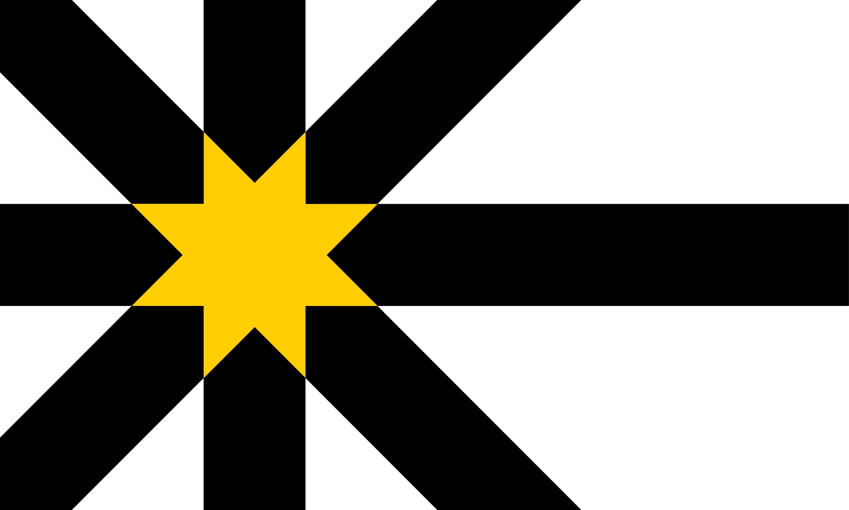
George Granville Leveson-Gower (1758–1833) married (1785) Elizabeth (countess of Sutherland in her own right) and was later named Duke of Sutherland. He was responsible for the notorious “Highland clearances” in the county (c. 1810–20), evicting thousands of families, burning their cottages and establishing large sheep farms. The evicted tenants were resettled in small coastal crofts, where they were forced to depend on fishing and the collection and burning of kelp. The pattern of rural depopulation continued through much of the 20th century. The Sutherland Flag comprises overlaid Saltire and Nordic crosses in black on a white background. The golden sun that is formed where the arms of the crosses meet symbolises the sun raised high in the south for the origin of the county's name South Land as well as the sunrises seen on the east coast and sunsets on Sutherland's west coast. The black recalls the peat of the Flow Country and dark skies and together with the white recall the central colours of the former Sutherland Council arms.