Search the Gazetteer
Are the results not as expected? Modify your search term or change the scope to refine your search.
Results for a place that exactly matches ...
Cumberland
Cumberland, England
 Cumberland is a maritime county in the north-west of England. The county's south and east is dominated by the Lake District with its stately, forbidding fells and cool, glittering lakes. Derwent Water, Buttermere, Crummock Water, Ennerdale Water, Wast Water, and part of Ullswater lie in Cumberland. Above them rise mountains, including England's highest Scafell Pike. Castlerigg stone circle is dramatically sited, with panoramic views of the fells. The tourist town of Keswick is nearby. West of the fells is Cumberland's coastal plain with the port towns of Whitehaven, Workington, Maryport and Silloth. The broad, green Eden Valley crosses the east of Cumberland, Penrith lying close to the Westmorland border. The cathedral city of Carlisle lies in the county's north, with the Solway Plain to its north. Hadrian's Wall runs from Bowness-on-Solway across the north of the county.
Portrait of Cumberland.
Place Type: Historic County
Lat, Long: 54.804729,-3.124809
Grid Reference: NY 2779 4612
Country: England
GBPN ID: 305759
GGA Code: C01000024
Entry Type: Main listing (P)
URL: https://gazetteer.org.uk/place/Cumberland
 Explore Cumberland on Wikishire
Derwent Water
The major tourist town of Keswick lies among the fells at the northern end of Derwent Water. Greta Hall was home to two of the great Lake Poets: Samuel Taylor Coleridge from 1800 until 1804 and Robert Southey from 1804 until his death in 1843. The hall was frequently visited by William and Dorothy Wordsworth and other literary figures including Byron and Shelley.
Castlerigg Stone Circle, east of Keswick, is one of the largest and most visually impressive stone circles in Britain. The stones stand in a natural amphitheatre created by the surrounding fells. From within the circle it is possible to see some of the highest peaks in Cumberland.
The valley of the River Duddon was beloved by Wordsworth who wrote in soaring praise of its beauty and quiet. The Duddon rises near the Three Shire Stone at the top of the Wrynose Pass which marks the point where Cumberland, Lancashire and Westmorland meet. From here the river tumbles south and south-west through Dunnerdale for fifteen miles before entering the Irish Sea at Duddon Sands. It forms the Cumberland - Lancashire border the whole way.
The market towns of Egremont and Cockermouth lie on the western edge of the Lake District. Egremont has the remains of a Norman castle. Much of Cockermouth is of mediæval origin substantially rebuilt in Georgian style with Victorian infill. Wordsworth House (NT) is a Georgian townhouse which was the birthplace and childhood home of William Wordsworth and Dorothy Wordsworth.

Wordsworth House in Cockermouth
To the west of the fells is Cumberland's coastal plain. This was formerly heavily industrialised, with coal mining, iron working and several prosperous ports. The traditional industries have gone and the trade through the ports has declined. Retail, services and tourism are now major parts of the economy. The Sellafield nuclear site at Seascale is a major employer, now focussed on the decommissioning of historic plants.
The town of Millom stands on the Duddon estuary in the southernmost point of Cumberland. Millom was constructed as a new town from 1866, built around ironworks.
St Bees Head is the most westerly part of the county. The cliffs rise to 200 feet and afford spectacular views of the coast and the fells. St Bees Priory was founded between 1120 and 1135. Its buildings now form the parish church of St Bees village.

St Bees Priory
Whitehaven is a port whose former prosperity led to the creation of a Georgian planned town in the 18th century. The port of Workington is home to "Uppies and Downies", a traditional version of football with its origins in Mediæval mob football. Maryport was created by Humprhey Senhouse in 1749 and named after his wife. The Romans established the fort of Alauna here around AD 122. The town has a Roman museum and a maritime museum.
Silloth, on the Solway Firth, developed a port town and a Victorian seaside resort. Tourism still flourishes, with dozens of static and touring caravan parks near the town.
The broad, green Eden Valley crosses from south to north across much of the east of Cumberland. The River Eden enters from Westmorland south of Edenhall. The market town of Penrith lies in the Valley close to the Westmorland border. The ruins of the 14th-century Penrith Castle lie on a site likely to have been a Roman encampment. To the north is the site of the Roman fort of Voreda, now known as Old Penrith.
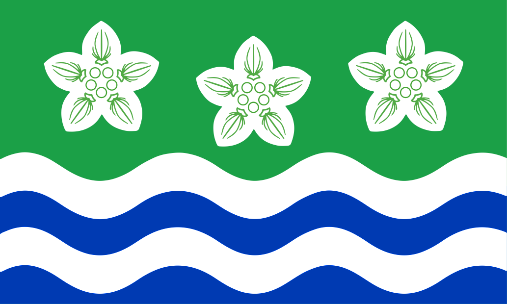
The Cumberland Flag at Beacon Edge near Penrith
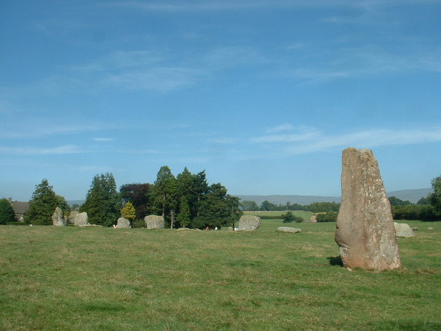
The Eden flows north past the village of Langwathby to Little Salkeld, close to the Bronze Age stone circle of Long Meg and Her Daughters. The circle has 59 stones set in an oval shape measuring 340 feet on its long axis. Long Meg herself is a 12-foot high monolith standing 80 feet to the south-west of her Daughters. Little Meg is a small stone circle to the north-east.

Long Meg and her Daughters
The Eden flows north past Great Salkeld, Lazonby, Kirkoswald, Armathwaite and Wetheral before eventually flowing through Carlisle before entering the Solway Firth. The famous Settle to Carlisle railway line runs through the valley.
East of the Eden, the Pennines cross into the south-east of Cumberland. Among them is Alston, which claims to be the England's highest market town, at about 1,000 feet above sea level.
In the north is Carlisle, a cathedral city, whose massive castle and fortifications against the Scots still dominate much of the town. Nicknamed the 'Border City', Carlisle is the main cultural, commercial and industrial centre for Cumberland. Carlisle Castle (EH) was built in 1092 by King William II. Carlisle Cathedral has a larger east window than any other cathedral in Britain.
The Solway Plain lies north and west of Carlisle, drained by the rivers Esk and Lyne. The small market town of Wigton is the thriving centre of the Plain. It is the hometown of writer and broadcaster Melvyn Bragg (Lord Bragg of Wigton).

Looking north from Longlands Fell across the Solway plain
Brampton is a small market town in the county's north-east, known for its cobbled street and historic sandstone houses. Nearby are Naworth Castle and Lanercost Priory.
The Hadrian's Wall Path runs from Bowness-on-Solway across much of the north of Cumberland. It runs alongside the remains of Hadrian's Wall, the defensive wall built by the Romans on the northern border of their empire. Birdoswald Fort is one of the best preserved along the Wall. The grassy ramparts of Bewcastle Roman Fort surround the Bewcastle churchyard.

Birdoswald Roman Fort on Hadrian's Wall
Across the county's north are fortified churches and "peel houses", built as a defence not so much against the Scots as against reivers, who terrorised the border country before the Union.


 Menu
Menu